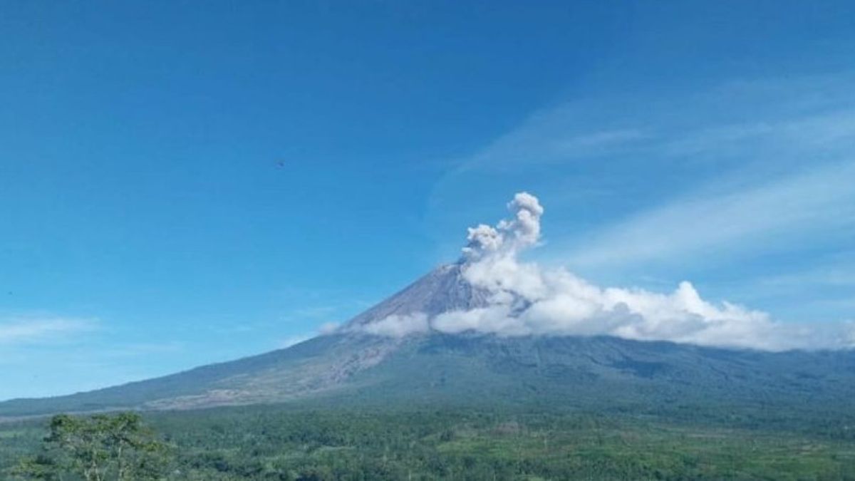


Mount Semeru, which is located on the border of Lumajang and Malang regencies, East Java, erupted four times with eruptions as high as 500 meters to 800 meters above the peak on Friday morning.
The first eruption occurred at 05.00 WIB with an eruption column height of 800 meters above the peak or about 4,476 meters above sea level (masl).
The ash column was observed to be gray with moderate to thick intensity to the northeast and was recorded on a seismograph with a maximum amplitude of 22 mm and a duration of 160 seconds.
"The merger erupted again at 06.28 WIB with an eruption column height of about 700 meters above the peak," said Mount Semeru Observation Post Officer Sigit Rian Alfian as quoted by ANTARA, Friday, April 4.
According to him, the ash column was observed to be white to gray with thick intensity to the northeast and the eruption was recorded on a seismograph with a maximum amplitude of 21 mm and a duration of 138 seconds.
Not long after, the highest mountain on the island of Java erupted again at 07.15 WIB with an eruptive column height observed about 500 meters above the peak or 4,176 meters above sea level.
"The ash column was observed to be white to gray with thick intensity to the north and northeast. The eruption was recorded on a seismograph with a maximum amplitude of 22 mm and a duration of 137 seconds," he said.
Then at 08.23 WIB, Mount Semeru erupted again with an eruptive column height of about 800 meters above the peak or 4,476 meters above the peak and a column of ash was observed to be white to gray with thick intensity to the northeast and the eruption was recorded on a seismograph with a maximum amplitude of 21 mm and a duration of 126 seconds.
Sigit explained that Mount Semeru is still on Alert or Level III status, so PVMBG provides recommendations so that people do not carry out any activities in the southeast sector along Besuk Kobokan, as far as 13 km from the summit (the center of the eruption).
Beyond this distance, the community does not carry out activities at a distance of 500 meters from the riverbank (river border) along Besuk Kobokan because it has the potential to be affected by the expansion of hot clouds and lava flows up to a distance of 17 km from the summit.
Then residents are also prohibited from doing activities within a 5 km radius from the crater/peak of Mount Semeru because they are prone to the danger of throwing stones (pijar).
The public is also asked to be aware of the potential for hot clouds, lava avalanches, and lahars along rivers/valleys that originate at the peak of the Semeru Volcano, especially along Besuk Kobokan, Besuk Bang, Besuk Kembar, and Besuk Sat as well as the potential for lahars in small rivers that are tributaries of Besuk Kobokan.
The English, Chinese, Japanese, Arabic, and French versions are automatically generated by the AI. So there may still be inaccuracies in translating, please always see Indonesian as our main language. (system supported by DigitalSiber.id)
Popular


