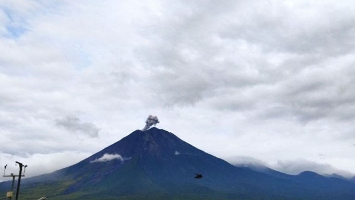


On Saturday morning, Mount Semeru, which is on the border of Lumajang and Malang regencies, East Java, erupted again with an eruption as high as 600 meters above the peak.
"There was an eruption of Mount Semeru at 07:23 WIB with an eruption column height of about 600 meters above the peak or about 4,276 meters above sea level (masl)," said Mount Semeru Observation Post Officer Yadi Yuliandi, quoted from ANTARA, Saturday, January 11.
According to him, the ash column was observed to be gray with thick intensity to the northeast. The eruption was recorded on a seismograph with a maximum amplitude of 22 mm and a duration of 100 seconds.
SEE ALSO:
-
 | BERITA
Polda Metro Sanksi Petugas Patwal Mobil RI 36 yang Viral karena Arogan
11 Januari 2025, 09:05 -
 | BERITA
BMKG Prediksi Cuaca Hari Ini Hujan Ringan di Hampir Seluruh Wilayah Indonesia
11 Januari 2025, 08:25

Based on officers' records, Mount Semeru erupted several times on Saturday with the first eruption occurring at 04:08 WIB, then at 04:31 WIB with an eruptive column height of about 700 meters above the peak and at 05:45 WIB with visual eruptions not being observed.
Yadi explained that Mount Semeru is still on Alert status, so the Center for Volcanology and Geological Hazard Mitigation (PVMBG) provides a number of recommendations, namely that people are prohibited from carrying out any activity in the southeast sector along Besuk Kobokan as far as eight kilometers from the summit (the center of the eruption).
Beyond that distance, people are not allowed to carry out activities at a distance of 500 meters from the riverbank (river border) along Besuk Kobokan, because it has the potential to be affected by the expansion of hot clouds and lava flows up to a distance of 13 kilometers from the summit.
"People are also not allowed to move within a radius of 3 kilometers from the crater/peak of Mount Semeru, because they are prone to the dangers of throwing incandescent stones," he said.
In addition, he continued, the public also needs to be aware of the potential for hot clouds, lava avalanches, and rain lava along rivers/valleys that originate at the top of Mount Semeru, especially along Besuk Kobokan, Besuk Bang, Besuk Kembar, and Besuk Sat, as well as the potential for lava in small rivers that are tributaries from Besuk Kobokan.
The English, Chinese, Japanese, Arabic, and French versions are automatically generated by the AI. So there may still be inaccuracies in translating, please always see Indonesian as our main language. (system supported by DigitalSiber.id)


