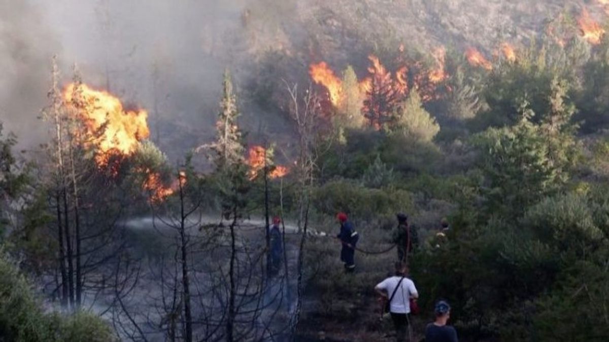


BALIKPAPAN - The Balikpapan Station Meteorology, Climatology and Geophysics Agency (BMKG) detected 111 hotspots spread across East Kalimantan Province, so that it became a notification to related parties as a measure of handling action.
"A total of 111 hotspots were monitored throughout last week from 01.00 to 24.00 WITA," said the Coordinator for Data and Information at the Sultan Aji Meteorological Station Muhammad Sulaiman - Sepinggan BMKG Balikpapan Station, Diyan Novrida, quoted by ANTARA, Monday, October 16.
According to him, hotspots are indicators of forest or land fires (karhutla) detected from a location, namely with relatively high temperatures compared to the surrounding temperatures.
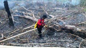
For this reason, he appealed to all parties to take care of each other and be vigilant, such as not throwing cigarette butts carelessly, then not burning when managing land so that forest and land fires do not occur.
The distribution of hotspots has been informed to related parties, including the Regional Disaster Management Agency (BPBD) both at the provincial and district levels in order to get further treatment.
A total of 111 hotspots spread over five districts, namely in Paser Regency 28 points, West Kutai nine points, Kutai Kartanegara 24 points, and Berau Regency four hotspots were observed.
اقرأ أيضا:
-
 | BERITA
Diduga Sengaja Dibakar, 5 Hektare Hutan dan Lahan di Balikpapan Ludes Terbakar
16 Oktober 2023, 07:33 -
 | EKONOMI
Pembenahan Bandara Kertajati Ditargetkan Rampung Sebelum 29 Oktober
15 Oktober 2023, 18:15 -
 | BERITA
Terganggu Kabut Asap, 2 Penerbangan ke Muara Taweh Kalteng Terpaksa Dibatalkan
13 Oktober 2023, 17:39 -
 | EKONOMI
Tingkat Pemulihan Pergerakan Penumpang Bandara AP 1 Sudah Capai 87 Persen
13 Oktober 2023, 11:06 -
 | BERITA
WNA Asal China Tewas dalam Kebakaran Smelter Nikel di Kutai Kartanegara Kaltim
13 Oktober 2023, 10:57
The details include in West Kutai Regency which detected nine hotspots spread over five sub-districts, namely Barong Tongkok District one, Damai one, Dilangputi three, Jempang two, and Siluq Ngurai District two hotspots.
"In Kutai Kartanegara Regency, 24 hotspots were observed spread over three sub-districts, namely Tabang District there were one, Sebulu District two points, and the rest 21 points spread across Muara Kaman District," said Diyan.
The English, Chinese, Japanese, Arabic, and French versions are automatically generated by the AI. So there may still be inaccuracies in translating, please always see Indonesian as our main language. (system supported by DigitalSiber.id)
العلامات الأكثر شيوعًا
#Prabowo Subianto #السنة الجديدة #pdip #هاستو كريستيانتو #ناتارو #عيد الميلادجمع