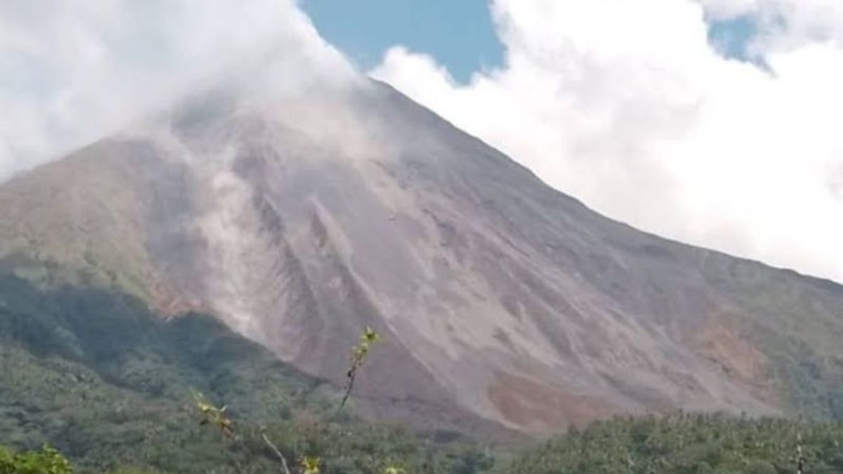


MANADO - The Geological Agency of the Ministry of Energy and Mineral Resources (ESDM) said that the effusive eruption of Mount Karangetang in Sitaro Islands Regency, North Sulawesi is still occurring.
Lava comes out of the southwest part of the main crater towards Batang River, Timbelang River, and West Beha River for about 1.000 meters. While those heading south enter Batuawang River and Kahetang River, the sliding distance is around 1.500 meters.
"Seismic data shows that high earthquake activity is still being recorded," said the Head of the Geological Agency at the Ministry of Energy and Mineral Resources, Sugeng Mujiyanto, in an evaluation of the activity of Mount Karangetang for the period June 18-22, 2023 through the PGA Karangetang Post chat group in Manado, reported by Antara, Monday, June 26.
Hot cloud avalanches in this period do not occur. However, it is necessary to watch out for the possibility of hot cloud avalanches occurring towards the south, namely to Kali Kahetang and Kali Batuawang.
"It is hoped that they will be aware of hot clouds of avalanches where the old lava dome is still at the top which can collapse at any time with the release of lava," he said.
Characteristics of hot clouds falling from Mount Karangetang, he said, occurred from the buildup of fallen/sliding lava material. The potential threat of the eruption of Mount Karangetang is the accumulation of material resulting from effusive eruptions in the valleys of the incandescent lava slide/fall path.
This has the potential to cause lava avalanches or hot clouds to fall downstream, so it is necessary to be vigilant of the people who live in the vicinity and the people who will cross the valley/river. In addition, it is also necessary to watch out for the occurrence of lava when it rains from the river that originates from the top of the crater.
The Geological Agency noted that seismicity during this period was recorded as many as 615 avalanches, 11 gusts, and 10 hybrid/multiphase earthquakes.
اقرأ أيضا:


Furthermore, five shallow volcanic earthquakes, seven deep volcanic earthquakes and 20 distant tectonic earthquakes, as well as continuous tremors with an amplitude of between 0.25-4 millimeters, two millimeters dominant.
The English, Chinese, Japanese, Arabic, and French versions are automatically generated by the AI. So there may still be inaccuracies in translating, please always see Indonesian as our main language. (system supported by DigitalSiber.id)
العلامات الأكثر شيوعًا
#Prabowo Subianto #دونالد ترمب #رمضان #عيد الفطر #المنتخب الإندونيسي #gazaجمع