

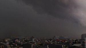
JAKARTA - The Meteorology, Climatology and Geophysics Agency (BMKG) predicts that weather conditions in Indonesia will generally rain along with the existence of two tropical cyclone seeds in the southeast of the Indian Ocean and the Gulf of Carpentaria.
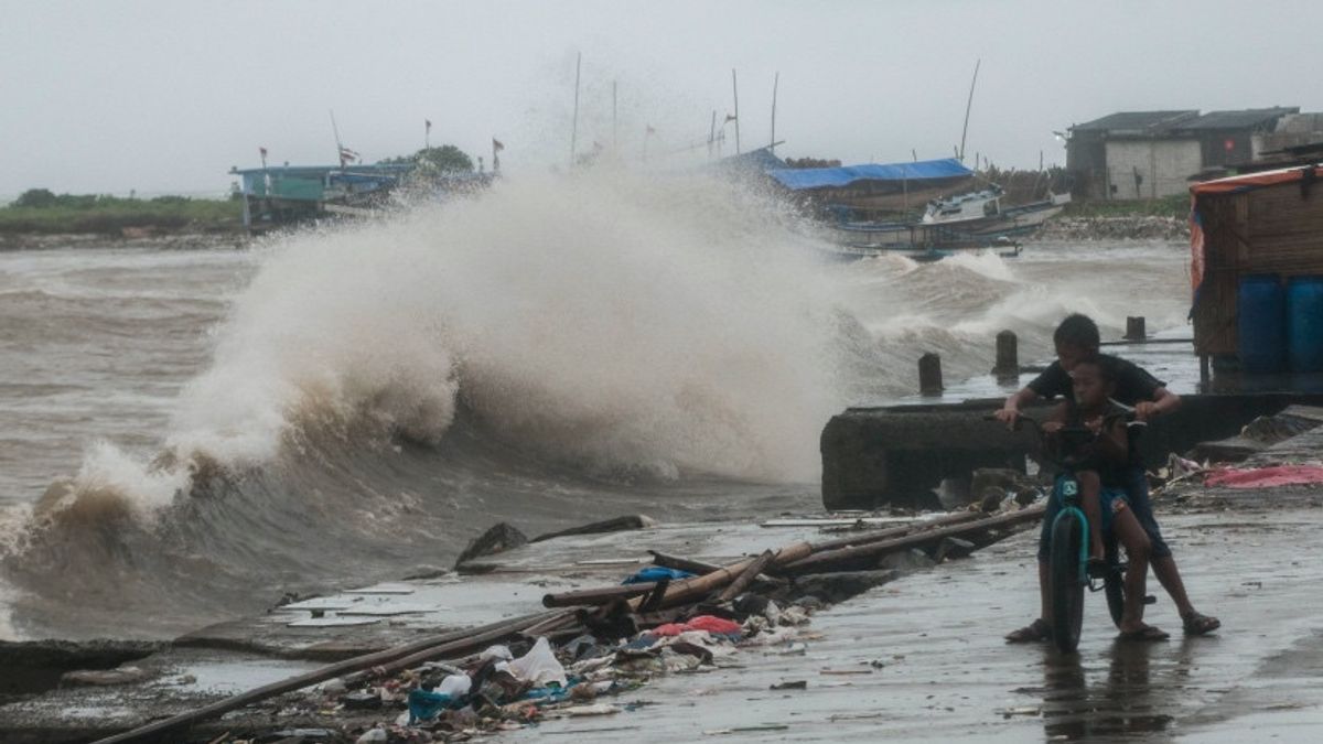
BMKG forecaster Nurul Tazaroh said the two systems induce an increase in wind speed of more than 50 kilometers per hour which can increase sea wave heights around these tropical cyclone seeds.
"The tropical cyclone seeds also form an area of deceleration of wind speed or convergence and wind confluence that extends from the Indian Ocean west of Bengkulu to Central Java," he said in a statement quoted by Antara in Jakarta, Sunday.
Nurul said thatmadden July oscillation (MJO) was identified as active in the continuous maritime which actively contributes to the process of forming rain clouds in Indonesia.
Based on BMKG predictions, the weather on the island of Sumatra is dominated by rain. Light rain forecasts fell in Bengkulu and Bandar Lampung.
Then, thunderstorms in Pekanbaru, Jambi, and Pangkal Pinang. Cloudy and cloudy skies have the potential to cover the areas of Padang, Tanjung Pinang, Medan, and Banda Aceh.
All areas on the island of Java are predicted to rain, namely Jakarta has the potential to experience light rain; Serang, Semarang, and Yogyakarta have moderate rain; and Surabaya experience thunderstorms.
The Sunda Kecil Islands is also predicted to rain, namely light rain in Denpasar and Kupang, then moderate rain in Mataram.
Furthermore, the weather on the island of Kalimantan is also dominated by rain. Light rain is predicted to fall in Tanjung Selor, Samarinda, and Palangka Raya.
Meanwhile, thunderstorm weather has the potential to occur in Banjarmasin and fog enveloping Pontianak.
In Sulawesi, light to moderate rain is predicted to fall in Makassar, Kendari, and Manado. Then, sunny cloudy weather has the potential to occur in Gorontalo, Palu, and Mamuju.
Meanwhile, for eastern Indonesia, light rain is generally showered, namely Jayapura, Ambon, and Ternate. Cloudy weather conditions are predicted to occur in Manokwari.
Based on BMKG monitoring, kelvin atmosphere waves were identified as active in central and southern Sulawesi as well as in the Maluku region.
Meanwhile, the equator's rossby waves were identified as active in the central and eastern parts of Java, Bali, West Nusa Tenggara, and East Nusa Tenggara.
관련 항목:

The prediction of the surface wind of the northern part of Indonesia is still dominated by winds blowing from the north north of the northeast. The southern region is dominated by winds blowing from the northwest with speeds ranging from 10 to 50 kilometers per hour.
Nurul asked the public to be aware of the potential for strong winds above 50 kilometers per hour in parts of Java, Bali, West Nusa Tenggara, East Nusa Tenggara, southern Maluku Islands, and southern Papua.
The air temperature generally ranges from 20 to 34 degrees Celsius with humidity ranging from 55 to 100 percent.
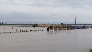
"The estimated sea wave height in Indonesia generally ranges from 0.5 to 2.5 meters. Beware of the potential for high waves of 2.5 to 4 meters which is estimated to occur in the Indian Ocean south of Central Java to East Nusa Tenggara, and in the Arafuru Sea," concluded Nurul.
The English, Chinese, Japanese, Arabic, and French versions are automatically generated by the AI. So there may still be inaccuracies in translating, please always see Indonesian as our main language. (system supported by DigitalSiber.id)