

SOURCE - Approximately 423 families (KK) in three jorongs or hamlets in South Solok Regency, West Sumatra (West Sumatra), were directly affected by the volcanic ash from the eruption of Mount Kerinci.
"Three jorongs in Nagari, Lubuk Gadang Tenggara, have experienced volcanic ash rain due to the eruption of Mount Kerinci since Wednesday (11/1) morning. On Thursday (12/1) volcanic ash is still falling," said Acting Wali Nagari in preparation for Southeast Lubuk Gadang, Sangir District, South Solok Regency, Sahrizal when contacted, Thursday, January 12, confiscated by Antara.
He explained that the three affected hamlets were Letter W Hamlet which consisted of 189 families, Teluk Air Putih inhabited 142 families and Lubuk Rasak inhabited 92 families.
Mount Kerinci's volcanic ash, he said, was seen covering the roofs of residents' houses and leaves, but it was still thin.
"The volcanic ash that reaches the three jorongs is only thin. People's activities are still normal," he said.
On Wednesday (11/1) night, he said, it rained so that the ash covering the roof of the house and leaves had disappeared.
He said that apart from the three jorongs who were in his area, Jorong Gunung Pasir, Nagari Lubuk Gadang, South Solok were also affected by volcanic ash.
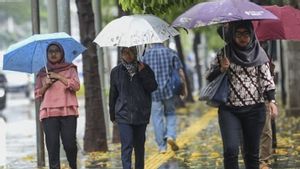
Considering that Mount Kerinci's volcanic activity is still increasing, he appealed to residents around the mountain to increase their vigilance and use masks if they are active outside the home.
"Vocational ash can interfere with health," he said.
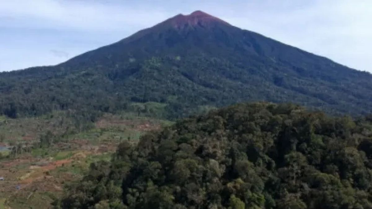
Mount Kerinci, which is located in Jambi and West Sumatra Province on Thursday, erupted again by ejecting volcanic ash as high as 600 meters, lower than the eruption on Wednesday (11/1).
"There has been an eruption of Mount Kerinci on January 12, 2023 at 06.20 WIB with a height of ash column observed at the peak of 600 m (8:405 m above sea level)," said Kerinci Volcano Observation Post officer Irwan Syafwan in a written statement received in Padang Aro, South Solok, West Sumatra, Thursday.
He added that the ash column was observed to be gray with moderate intensity leaning towards the northeast and east.
This eruption was recorded on a seismogram with a maximum amplitude of 2 mm and a temporary duration of 13 minutes 20 seconds. The seismogram was recorded with a continuous tremor with an amplitude of 1-4 dominant 2.
"The eruption is still ongoing while reports are being made," he said.
The highest active volcano in Southeast Asia is currently at Level II (Alert) Status.
People around Mount Kerinci and visitors / tourists are prohibited from climbing craters at the top of the mountain within a radius of 3 km from the active crater (the public is prohibited from doing activities within the danger radius / KRB III).
It is better if flight routes around Mount Kerinci are avoided because at any time they still have the potential for ash eruptions with heights that could disrupt flight routes.
Previously, the mountain, which is located in Kerinci Regency and South Solok Regency, experienced an eruption on January 11 with a height of ash column being observed at ~ 900 m above the peak (that is 4,705 m above sea level).
The English, Chinese, Japanese, Arabic, and French versions are automatically generated by the AI. So there may still be inaccuracies in translating, please always see Indonesian as our main language. (system supported by DigitalSiber.id)