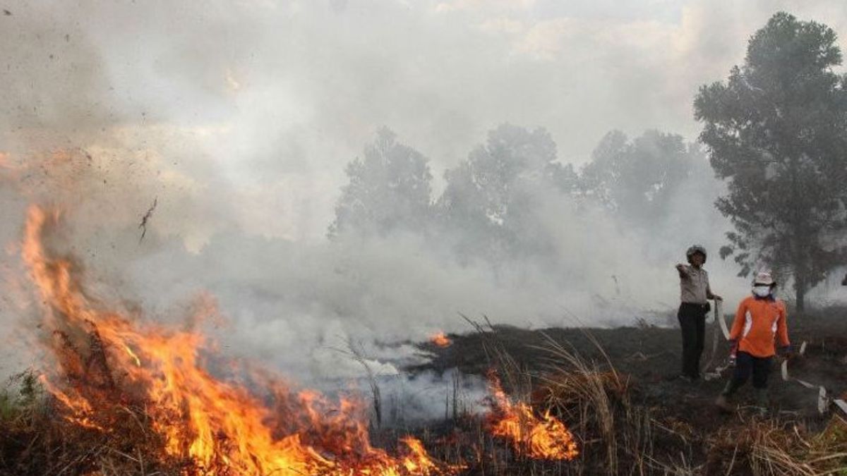
JAKARTA - The most hotspots were recorded in the coal mine pit area when they were on standby for forest and land fires (karhutla) 2023.
This was conveyed by the Regional Disaster Management Agency (BPBD) of Tapin Regency, South Kalimantan.
"His condition is not dangerous," said Head of BPBD Tapin Raniansyah quoting Antara.
Based on the source of the hot spot monitoring data used by BPBD through the Sipongi.menlhk.go.id website, since the last 10 days there have been 60 moderate hotspots in Tapin.
It is recorded that the period of time at each point varies, from one day to eight consecutive days.
The distribution of hotspots is located in Lokpaikat District, Bungur District, South Tapin District and Binuang District. A total of 54 hotspots in the coal mining hole area, while the other six points are in the agricultural land area.
BPBD's actions so far, said Raniansyah, are conducting direct monitoring to the field and coordinating with parties in the area closest to the hotspot to avoid the threat of forest and land fires risk.
"In the area of the mine hole, hot smoke came out," he said.
He ensured that from a number of hotspots there were no fires that spread to land, forests, and community settlements in the coal mining area.
"We continue to be ready," he said.
Previously, the Daily Executor of the Head of the Regional Disaster Management Agency (Plh Kalaksa BPBD) of South Kalimantan Province, Bambang Dedi Mulyadi, said that currently there are 42 hectares of forest and land fires in the local province.
"Based on the data we have collected, currently the forest and land fires in South Kalimantan have hit a land of around 42 hectares," said Bambang Dedi Mulyadi.
Bambang said the fire that occurred in South Kalimantan was still in the ordinary category, because officers were still able to overcome the source of the fire.
Currently, said Bambang, all officers are on guard and patrolling with extra alert status for 1x24 hours.
Meanwhile, the Chairman of the South Kalimantan BPBD Rapid Response Team (TRC) Mansyah said that of the total 42 hectares of burned land, not only affected by weather factors.
Several areas that were hit by forest and land fires were dominant, namely Banjarbaru City, Banjar Regency, Tanah Laut Regency, and Tapin Regency.
"There are still residents who do not understand well the impact of burning land," said Mansyah.
He added that the most extensive impact of forest and land fires occurred in Tanah Laut Regency, which reached eight hectares.
According to him, many people carry out intentional or unintentional arson.
Mansyah revealed that his party was trying to approach residents and provide guidance so as not to burn the land.
He hopes that residents will be concerned about the impact of the fire, so that it does not burn, especially now that hot weather is hitting South Kalimantan.
Furthermore, he said personnel found indications of the fire caused by the community.
At several points of fire, he said, there were already several wooden stakes installed by residents as a sign of land burning.
The English, Chinese, Japanese, Arabic, and French versions are automatically generated by the AI. So there may still be inaccuracies in translating, please always see Indonesian as our main language. (system supported by DigitalSiber.id)


