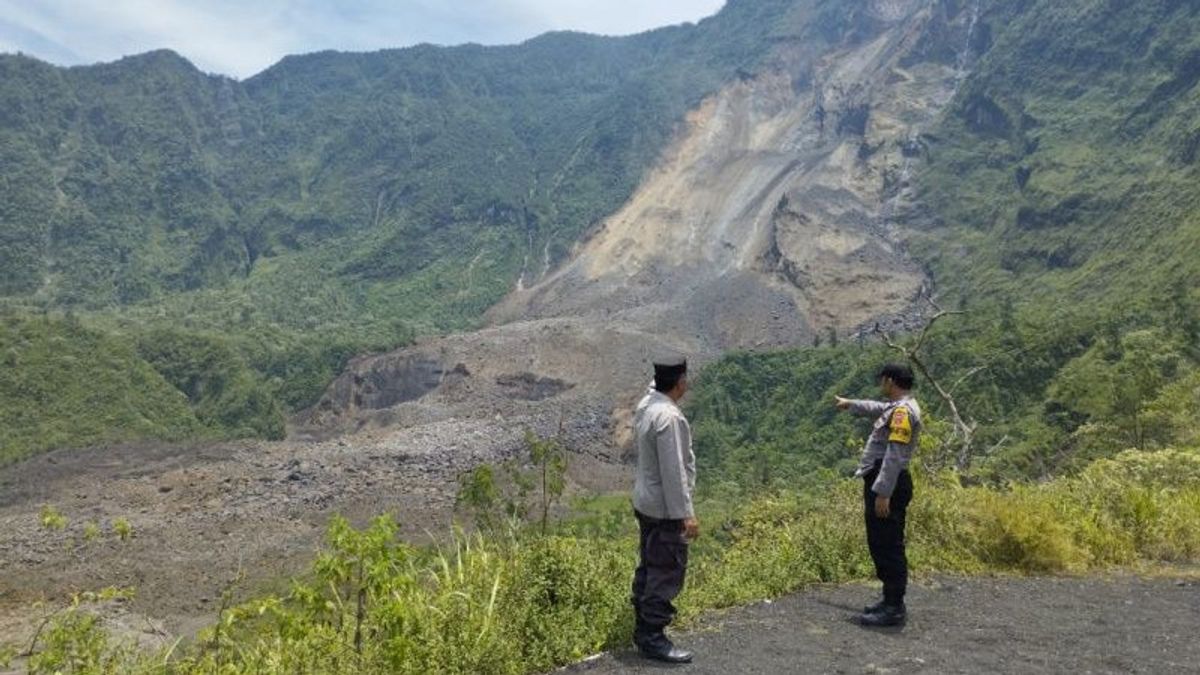
Another landslide occurred in a cliff area on Mount Galunggung, Tasikmalaya Regency, West Java (West Java). The disaster occurred due to the high intensity of rain causing a large landslide in the Perhutani area and hit some of the craters below it.
"The landslide is on the west wall. The impact of the avalanche is about 7 hectares," said Site Priangan Perhutani Tasikmalaya Manager, Sumarsono, when contacted by reporters in Garut, West Java, Monday, March 13, as reported by Antara.
He said that the landslide in the Puncak area of Mount Galunggung was based on records that it had occurred since 2017, then in a few years of vulnerability, landslides occurred again.
Finally, the landslide occurred, he said, on Saturday, March 11 at midnight and Sunday, March 12 in the morning, which according to information, residents had caused a rumbling sound.
"Now there are more incidents on Sunday nights, there are more avalanches, there are voices. According to information, it happened at 11 pm and at 5 am," he said.
He said the landslide was quite far from residential areas so it did not threaten the dangers of the community.
Since the landslide in Galunggung, he said, people have been prohibited from going down to the crater, let alone drinking the lake water below, for fear of disturbing health.
"Meanwhile, we are closing the area, no one should go down to the crater," he said.
The head of the Galungung Gunung Monitoring Post (PGA) in Padakembang District, Tasikmalaya, Gradita Frihadi added that the avalanche occurred at the crater wall of the peak of Mount Galunggung which had occurred since 2017 and finally with a large landslide on Saturday, March 11 evening.
Prior to this new landslide, he said, in the previous two weeks there had also been landslides. However, the scale is small, different from the one where the last incident brought quite a lot of avalanche material and covered some of the craters.
He revealed that the monitoring results of the landslide incident were not due to the active mountain activity, but the impact of the high intensity of rain in the peak area.
"The combination is quite steep, there is a flow of water from the Purba Crater which is possible to erode the crater wall," he said.
He conveyed that the public and tourists are prohibited from approaching landslides, let alone descending under the crater because it is dangerous.
Tourists, he said, could still visit the Mount Galunggung tourist attraction because the avalanche location was quite far away.
"To get to the stairs or the lips of the crater, it's still okay, as long as you don't go down," he said.
The English, Chinese, Japanese, Arabic, and French versions are automatically generated by the AI. So there may still be inaccuracies in translating, please always see Indonesian as our main language. (system supported by DigitalSiber.id)


