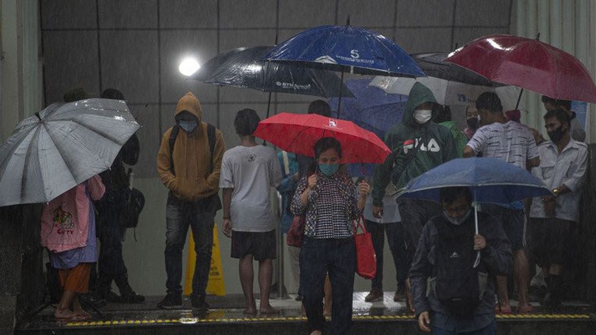


JAKARTA - The DKI Jakarta Regional Disaster Management Agency (BPBD) recorded that 11 roads and 21 RTs were flooded as of 11.00 WIB. This is due to rain with moderate to heavy intensity in the capital city on Thursday, February 23 night until this afternoon.
"*BPBD noted that previously inundation occurred in 5 roads and 10 RTs, currently there are 11 roads inundated and 21 RTs or 0.069 percent of the 30,470 RTs in the DKI Jakarta area," said Head of BPBD DKI Jakarta Isnawa Adji in his statement, Friday, February 24.
Isnawa said the highest rainfall was in Muara Angke with a height of 101 millimeters per day.
BPBD DKI Jakarta mobilizes personnel to monitor inundation conditions in each region and coordinate elements of the Natural Resources Service, Highways Office, Gulkarmat Service to carry out inundation suction and ensure water lines function properly together with local lurah and sub-district heads.
"The inundation is targeted to recede in a short time. He said. BPBD DKI appealed to the public to remain careful and alert to potential inundation," he said.
The following is a list of inundated roads:
1. Jl. Begog River, Kel. Semper Timur Kec. Cilincing, North Jakarta. Ketinggian: 20 cm2. Jl. Madya Kebantenan RT 06/02, Kel. Semper Timur, Kec. Cilincing, North Jakarta had receded at 12:30 WIB and was again inundated at 23:03 WIB The height: 15 cm3. Jl. Kramat Raya, Kel. North Tugu, Kec. Koja, North Jakarta had receded at 12:40 WIB and was again inundated at 22:37 WIB The height: 10 cm4. Jl. Kel Hamlet. Lagoa, Kec. Koja, North Jakarta The height: 10 cm5. Jl. Environment III, Rt.03, 015/03, Kel. Tegal Alur, Kec. Kalideres, West Kalideres, Ketinggi: 25 cm6. Jl. Mangga Raya, Kel. North Tugu, Kec. Koja Altitude: 25 cm7. Jl. Central Karang Raya Lebak Bulus, South Jakarta. Altitude: 30 cm8. Jl. Lebak Bulus Raya Agriculture, South Jakarta. Altitude : 20 cm9. Jl. Big Bungur Raya Kel. Senen kec. Central Jakarta Senen, height : 20 cm10. Jl. State Printing II Kel. Johar Baru, Kec. Johar Baru, High: 20 cm11. Jl. Petamburan (front Petamburan Village Office) Kec. Tanah Abang, Altitude : 20 cm
Meanwhile, 21 RTs were flooded, namely: East Jakarta 1. East Cakung- Total: 1 RT- Altitude: 20 cm- Cause: High rainfall
2. Kel. Cililitan- Total: 1 RT- Altitude: 50 cm- Cause: High rainfall & overflow of Ciliwung River
3. Kel. Cawang- Total: 2 RT- Altitude: 120 cm- Cause: High rainfall and overflow of Ciliwung River
4. Kel. Kampung Melayu- Jumlah: 2 RT- Altitude: 75 cm- Cause: High rainfall and overflow of Ciliwung River
5. Kel. Chinese Midara- Total: 1 Neighborhood- Altitude: 65 cm- Cause: High rainfall and overflow of Ciliwung River
North Jakarta dance1. Kel. Marunda- Total: 1 RT- Altitude: 25 cm- Cause: High rainfall
West Jakarta 1. Kel. Tegal Alur- Number: 4 RT- Altitude: 30 cm- Cause: High rainfall
2. Kel. Kamal- Jumlah: 1 RT- Altitude: 20 cm- Cause: High rainfall
3. Kel. South Kembangan- Total: 2 Neighborhoods- Altitude: 30 cm- Cause: High rainfall
4. Kel. Joglo- Total: 1 RT- Altitude: 55 cm- Cause: High rainfall
5. Kel. Rawa Buaya - Summary: 1 RT- Altitude: 20 cm- Cause: High rainfall and overflow of Angke River
6. Kel. Duri Kosambi- Jumlah: 2 RT- Altitude: 30 cm- Cause: High rainfall
South Jakarta 1. Kel. Petogogan- Total: 1 RT- Altitude: 20 cm- Cause: High rainfall and overflow of Ciliwung River
2. Kel. Kuningan Barat- Jumlah: 1 RT- Altitude: 60 cm- Cause: High rainfall
The English, Chinese, Japanese, Arabic, and French versions are automatically generated by the AI. So there may still be inaccuracies in translating, please always see Indonesian as our main language. (system supported by DigitalSiber.id)
Tags les plus populaires
#NCP #Shin Tae-yong #Seuil présidentiel #Hasto Kristiyanto #squid game 2Populaire