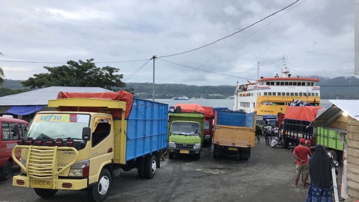
AMBON - The assistant port of Galala Ferry Port has temporarily suspended inter-island shipping activities on the Galala Ambon-Namlea route, due to bad weather that hit Ambon today.
"The cruise has been postponed while waiting for further information from the harbor office," said the General Manager (GM) of PT. Ambon River, Lake and Crossing Transportation (ASDP), Anton Murdianto, quoted by ANTARA, Tuesday, July 5.
He said the temporary suspension of inter-island shipping followed up a letter from the weather forecast for the shipping area from the Meteorology and Geophysics Agency (BMKG) for the Ambon Maritime Station, dated July 5, 2022, at 09.00 WIT to July 6, due to an early warning due to high waves 2.5-4. meters.
Anton conveyed that high waves are likely to occur in the waters of Buru, Ambon Lease waters, the southern waters of Seram Island, the Banda Sea, the waters of the Tanimbar Islands, the waters of the Kei Islands, the waters of the Aru Islands, and the Arafuru Sea.
“This is only for Galala and Namlea Ports. As for Hunimua Ambon and Waipirit, West Seram (SBB), it is still relatively safe," he said.
The departure of the ship to Namlea from Galala Harbor will be further informed while waiting for the sea wave conditions to improve.
"Once again, we urge you, collective safety is more important, so please be patient. If the waves have improved, the ship will return to operation," concluded Anton.
It is known, the Meteorology, Climatology and Geophysics Agency (BMKG) issued an early warning of high waves of up to 4 meters, which could potentially occur in several Maluku waters.
This high wave potential is caused by the wind pattern in the northern part of Indonesia that is dominantly moving from Southeast to South with wind speeds ranging from 5 to 20 knots.
Meanwhile, in the southern part of Indonesia, the dominant movement is from East - Southeast with wind speeds ranging from 5 - 30 knots. The highest wind speeds were observed in the northern waters of Sabang, the western waters of Aceh, the southern waters of the Java Island to NTT, the Banda Sea, the Kep. Sermata - Kep. Tanimbar, and the Arafuru Sea.
The potential for high waves of 2.5 to 4 meters occurs at seven points, namely the waters of Buru Island, Ambon Island and Lease, the southern waters of Seram Island, the Banda Sea, the waters of the Tanimbar Islands, Kai Islands, Aru Islands and Arafuru Sea.
Waves as high as 1.25 -2.5 meters (moderate) are also likely to occur in the Seram Sea, the waters of the Sermata - Leti Islands, and the waters of the Babar Islands.
BMKG appealed to the public to pay attention to the high risk of shipping safety. High risk for fishing boats, if the wind speed is more than 15 knots and the wave height is above 1.25 meters, while the barge is 16 knots with a wave height of 1.5 meters.
While the high risk for ferries with wind speeds of more than 21 knots and wave heights above 2.5 meters, and large ships, such as cargo ships or cruise ships, the risk is high if facing wind speeds above 27 knots and wave heights above 4 meters.
He appealed to operators of passenger ships, cargo ships, and fishing boats to be aware of the threat of high waves.
The English, Chinese, Japanese, Arabic, and French versions are automatically generated by the AI. So there may still be inaccuracies in translating, please always see Indonesian as our main language. (system supported by DigitalSiber.id)
