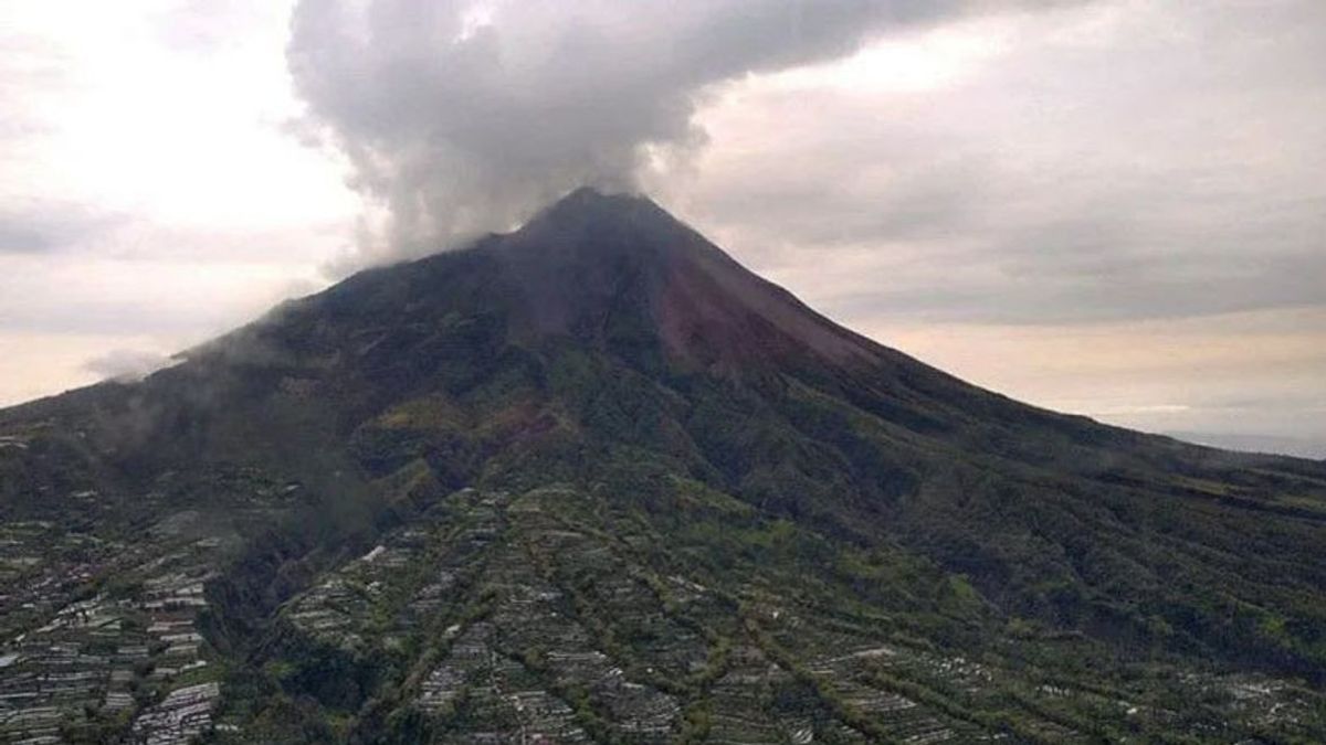


JAKARTA - Mount Merapi on the border of Yogyakarta and Central Java released incandescent lava eight times on Tuesday, June 21. Glide with a maximum distance of 1,800 meters (1.8 km) to the southwest from 00.00 to 06.00 WIB.
According to the Head of the Center for Research and Development of Geological Disaster Technology (BPPTKG) Agus Budi Santoso, during the observation period, Merapi also experienced 20 avalanches with an amplitude of 3-13 mm for 42-124 seconds.
On Tuesday morning, low-pressure crater smoke was observed to be white with moderate intensity and 50-100 meters high above the crater peak.
Based on the results of morphological analysis in the period 27 May - 2 June 2022, no changes in height were observed, neither the southwest dome nor the central dome.
The volume of the southwest lava dome was recorded at 1,551,000 cubic meters, and the middle dome of Merapi was 2,582,000 cubic meters.
Until now, BPPTKG still maintains the status of Mount Merapi at Level III or Alert, quoted from Antara.
Lava flows and hot clouds from Mount Merapi can impact areas within the south-southwest sector which include the Boyong River (a maximum of five km) and the Bedog, Krasak, Bebeng Rivers (a maximum of seven km).
In addition, lava flows and hot clouds from Mount Merapi can impact areas in the southeastern sector which include the Woro River (a maximum of three km) and the Gendol River (a distance of five km).
If the volcano experiences an explosive eruption, then the ejection of volcanic material can reach an area within a radius of three kilometers from the top of the mountain.
The English, Chinese, Japanese, Arabic, and French versions are automatically generated by the AI. So there may still be inaccuracies in translating, please always see Indonesian as our main language. (system supported by DigitalSiber.id)
Tags les plus populaires
#Prabowo Subianto #Golkar #élections jakarta #jeux d’argent en ligne #Mount Lewotobi malePopulaire