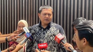
JAKARTA - The Meteorology, Climatology and Geophysics Agency (BMKG) anticipates an earthquake and tsunami that could hit Ngurah Rai Airport, Bali at any time.
In a press release received Thursday, February 10, BMKG Head Dwikorita Karnawati who was accompanied by the General Manager of Ngurah Rai Airport said the existence of Ngurah Rai Airport is very vital for Indonesia, because it is the main entrance for tourists from various countries.
Bali, according to Dwikorita, is one of Indonesia's mainstay tourist destinations and a favorite of world tourists. In addition, various international agendas are often held on the island.
"The distance between the airport and the beach is 0 meters and this has a great potential to be swept away by a tsunami, if at any time a large earthquake hits Bali," said Dwikorita.
BMKG has made at least three efforts to anticipate the threat of such a disaster.
First, improve modeling accuracy related to Tsunami hazards. Moreover, this airport is located on the coast facing an earthquake source with the potential for a tsunami or the occurrence of a megathrust south of Bali.
Second, by installing an earthquake and tsunami information receiving system (WRS New Generation) which will be integrated into the existing system at the command center of Ngurah Rai Airport. This WRS allows the public and all airport users to know of an earthquake and the potential for a tsunami to occur in less than 5 minutes or about 2-4 minutes.
Third, BMKG will carry out educational efforts to stakeholders and officers related to rescue at the airport, by training and conducting evacuation drills or simulations related to responding to earthquake and tsunami information quickly and accurately, for rescue efforts at the airport.
“Mitigation must also be carried out by the provincial government and local district/city governments to further minimize the impact of losses and casualties. Considering that in the location around the airport, there are also many economic areas and residential areas," said Dwikorita as quoted from Antara.
Dwikorita said this reality should be a record for the government and all parties when they want to build infrastructure, because Indonesia's territory is in the ring of fire so that it is prone to earthquakes and tsunamis.
Ideally, he said, the construction of various public facilities is directed at areas that are safe from disasters to avoid casualties and losses.
Meanwhile, during his visit to Ngurah Rai Airport, Dwikorita also ensured that all weather observation equipment supporting flight safety at Ngurah Rai was in good condition.
Weather data, such as wind speed and direction, rainfall, air pressure, visibility distance, cloud base height and so on issued by the BMKG are very important in making a flight plan and for taking off planes. This data plays an important role in ensuring the safety and comfort of passengers.
Dwikorita inspected the readiness of the Automated Weather Observing System (AWOS) at the end of the runway at Ngurah Rai Airport. AWOS is equipped with a number of sensors such as temperature and humidity sensors, pressure sensors, rainfall sensors, wind direction and speed sensors, and solar radiation sensors.
"Soon the G20 Summit will be held in Bali, next October. BMKG has also made various preparations, because this airport during the event will be very busy. All tools are continuously checked to ensure they are running optimally in order to produce accurate, fast, and precise data," he said.
The English, Chinese, Japanese, Arabic, and French versions are automatically generated by the AI. So there may still be inaccuracies in translating, please always see Indonesian as our main language. (system supported by DigitalSiber.id)


