

JAKARTA - Google Maps has been around for 17 years since it was first launched in 2005. Google Maps can provide a lot of real-time information about the road you are about to take.
Now, Google is adding another capability in its app. You can see the estimated toll price before starting your long journey.
For the planner friend: this new feature is for you. 🙏Now when you're planning trips big and small, you can check estimated toll prices before you pick a route—and spend what you save on road snacks. pic.twitter.com/Lfy8s2TXQU
— Google Maps (@googlemaps) June 13, 2022
"Now when you're planning trips big and small, you can check the estimated toll prices before choosing a route and spend what you save on street food," Google said on Twitter.
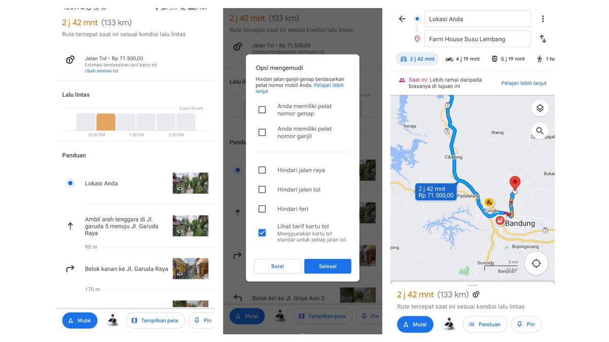
Users in the US, India, Japan and Indonesia will be the first to get toll data on Google Maps. According to VOI monitoring, users in Indonesia can now see this new tool from Google on the Google Maps mobile application.
What should be noted is that Google Maps does not show the total price of each toll road traversed, they only show the estimated price to get to your destination.
View Estimated Toll Prices on Google Maps Go to Google Maps. Enter your current location and destination address. Choose a trip by car. In the route that appears, Google Maps will show the estimated toll price. If you want more information, swipe up on the menu that shows the estimated travel time.The English, Chinese, Japanese, Arabic, and French versions are automatically generated by the AI. So there may still be inaccuracies in translating, please always see Indonesian as our main language. (system supported by DigitalSiber.id)
Most Popular Tags
#Prabowo Subianto #donald trump #2026 World Cup #Febrie Adriansyah #8791Popular


