

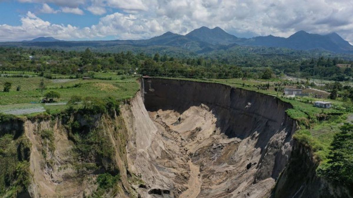


JAKARTA - The Head of the Geological Disaster Research Center of the National Research and Innovation Agency (BRIN) Adrin Tohari revealed the actual cause of the landslide or sinkhole event that occurred in Ketol, Central Aceh some time ago.
"What happened in Central Aceh was actually a landslide phenomenon, not a sinkhole. The tuff layer is not dense and its strength is low, so it is easy to erode and collapse," he said as reported by ANTARA, Saturday, February 21.
Adrin continued, Google Earth satellite images since 2010 in the area have actually shown the presence of a small valley or gorge. Over time, the erosion and landslide process continued so that the valley widened and lengthened until it formed a large hole that is visible today.
He also suspected that the earthquake factor contributed to accelerating the process. The earthquake with a magnitude of 6.2 that occurred in Central Aceh in 2013 likely weakened the slope structure, triggering greater instability.
In addition to geological factors and earthquakes, heavy rain is the main trigger. Fragile tuff rocks are easily saturated by water, so they lose their binding power and eventually collapse. The steep slope due to the previous landslide process also aggravates the condition.
Adrin explained that surface water from the plantation irrigation canal also contributed to the acceleration of landslides. The water that flows rapidly and seeps into the ground increases the humidity of the tufa layer, thus increasing the risk of collapse.
"If the irrigation channels are open and water continues to enter the ground, the already fragile layer becomes increasingly unstable," he said.
Adrin also put forward the hypothesis of groundwater flow at the boundary between the lava flow layer at the base of the denser cliff and the fragile tufa rock above it. Erosion at the foot of the slope by groundwater can cause the upper part of the cliff to lose its support and collapse gradually.
According to him, this phenomenon does not occur suddenly, but is a process that lasts tens to hundreds of years. Earthquakes and rain only play a role in accelerating the natural process of forming the valley or gorge.
Adrin said similar conditions could be found in other areas that have the geological character of young volcanic rocks. He cited the Sianok Gorge in West Sumatra, which was formed through a long geological process related to the tectonic activity of the Great Sumatra Fault with similar rock characteristics.
"We are still limited to analyzing based on image data and public information. To ensure the cause in detail, a comprehensive study is needed," he explained.
Adrin assessed that further research could be carried out using geophysical methods such as geoelectric surveys, seismic reflection, and microtremor to find out the structure below the surface, the potential for cracks, and the factors that make slopes prone to landslides.
He also emphasized the importance of mitigation, especially controlling surface water so that it does not seep into the ground, determining the danger zone, and installing a landslide early warning system. He reminded the public to be alert to early signs such as the appearance of soil cracks or small subsidence.
"The vulnerability map of land movements actually exists, but it needs to be updated after this incident so that it is more accurate and operational. The most important thing now is to understand the process and immediately take mitigation steps so that the risk of human casualties can be avoided," said Adrin Tohari.
By Sean Filo Muhamad
The English, Chinese, Japanese, Arabic, and French versions are automatically generated by the AI. So there may still be inaccuracies in translating, please always see Indonesian as our main language. (system supported by DigitalSiber.id)


