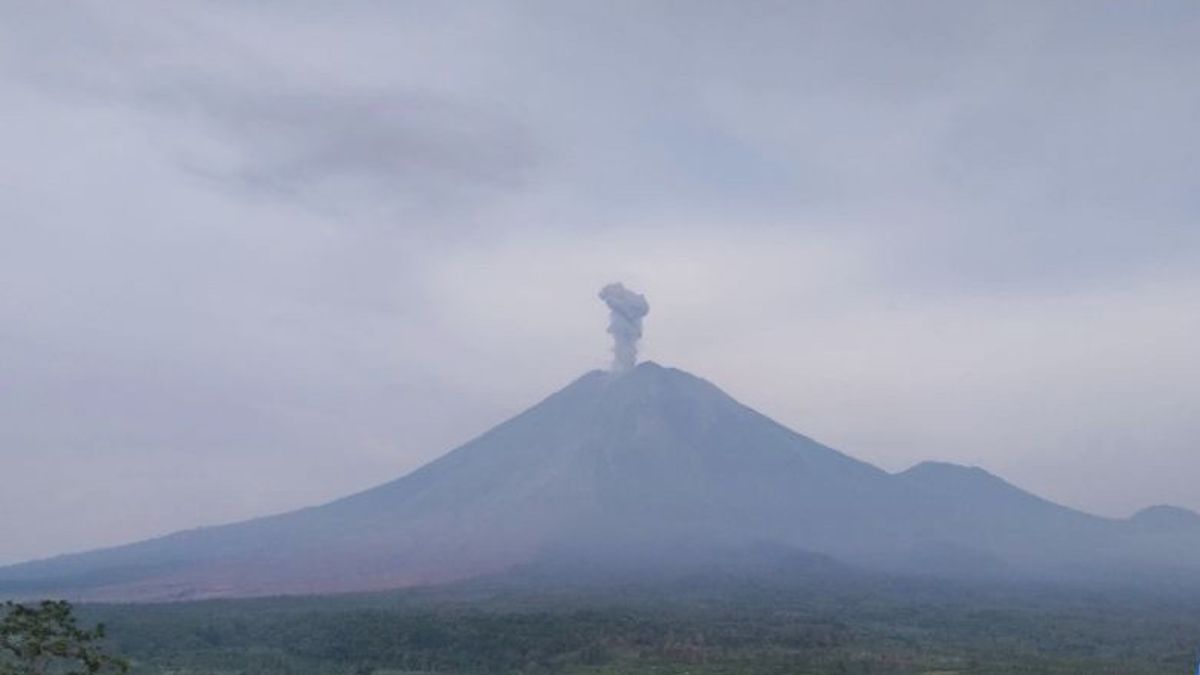


JAKARTA - Mount Semeru, which is on the border of Lumajang and Malang Regencies, East Java, has erupted three times with an eruption height of 900 meters above the peak on Wednesday, December 31 morning ahead of New Year 2026.
"The first eruption occurred at 00.04 WIB with an unobservable eruption, but was recorded on the seismograph with a maximum amplitude of 22 mm and a duration of 150 seconds," said Mount Semeru Observation Post Officer Mukdas Sofian in a written report received in Lumajang, Wednesday, quoted by Antara.
Then the second eruption occurred at 05.34 WIB with the height of the observed eruption column about 700 meters above the peak (4,376 meters above sea level).
"The observed ash column is white to gray with a thick intensity towards the southwest. The eruption was recorded on the seismograph with a maximum amplitude of 22 mm and a duration of 130 seconds," he said.
The third eruption occurred at 06.29 WIB with the height of the observed eruption column about 900 meters above the peak and the ash column was observed to be white to gray with a thick intensity towards the east and southeast.
"The eruption was recorded on the seismograph with a maximum amplitude of 22 mm and a duration of 125 seconds," said Mukdas Sofian.
He explained that currently Mount Semeru is at Level III (Alert) status, so the Center for Volcanology and Geological Hazard Mitigation (PVMBG) has provided a number of recommendations.
"People should not carry out any activities in the southeast sector along Besuk Kobokan, as far as 13 km from the peak (the center of the eruption)," he said.
Outside this distance, he continued, the public should not carry out activities at a distance of 500 meters from the river bank (river border) along Besuk Kobokan because they have the potential to be hit by the expansion of the hot cloud and lava flow up to a distance of 17 km from the peak.
The public is also prohibited from carrying out activities within a radius of five kilometers from the crater/peak of Mount Semeru because they are prone to the danger of stone throwing (pijar).
Then residents need to be aware of the potential for hot clouds, lava discharge, and lava along the river/valley flow upstream of the summit of Mount Semeru, especially along Besuk Kobokan, Besuk Bang, Besuk Kembar, and Besuk Sat, as well as the potential for lava on small rivers which are tributaries of Besuk Kobokan.
The English, Chinese, Japanese, Arabic, and French versions are automatically generated by the AI. So there may still be inaccuracies in translating, please always see Indonesian as our main language. (system supported by DigitalSiber.id)
Most Popular Tags
#Prabowo Subianto #donald trump #2026 World Cup #venezuela #konflik timur tengahPopular


