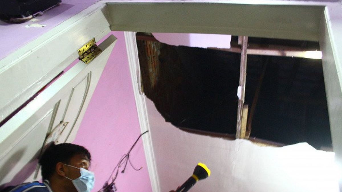


JAKARTA - The Bureau of Meteorology, Climatology and Geophysics (BMKG) urges the public to be aware of buildings that are cracked by earthquakes during the situation of potential aftershocks, after the earthquake that occurred in Blitar, East Java with a magnitude of 6.2.
"Aftershocks will continue, and buildings that start to crack if they can not enter first, because although small aftershocks can cause buildings to collapse and cause fatalities," bmkg geophysical deputy M Sadly said at a press conference in Jakarta on Friday night, quoted from ANTARA.
Sadly said although aftershocks are small, but it should be considered if it causes damage to buildings or structures there is a decrease in strength, because previously shaken by the earthquake.
Bambang said that although earthquake activity in southern Java has increased, he asked the public not to panic and always be vigilant and pay attention to self-evacuation measures in the event of a tsunami.
BMKG mentioned that the earthquake in the southeast of Blitar Regency, East Java, on Friday at 19.09 WIB occurred due to subduction activity of the Indo-Australian Plate.
"By paying attention to the location of the epicenter and the depth of the hypocenter, the earthquake that occurred is a type of intermediate earthquake due to subduction of the Indo-Australian Plate that hit the Eurasian Plate," bmkg Earthquake and Tsunami Center Head Bambang Setiyo Prayitno said in a written statement received in Jakarta on Friday.
Head of BMKG Earthquake and Tsunami Center Bambang Setiyo Prayitno in a written statement received in Jakarta on Friday. BMKG initially stated that the earthquake, which was centered in the sea about 57 kilometers southeast of Blitar Regency at a depth of 110 kilometers, had a magnitude of 6.2 but later upgraded it to 5.9.
After Blitar, the Bureau of Meteorology, Climatology, and Geophysics (BMKG) in its official Twitter account said there had been a magnitude 5.2 earthquake in Enggano, Bengkulu, Saturday at 01.36 WIB.
BMKG said the coordinates of the earthquake were at 5.09 South Cross-102.14 East Longitude or 31 km northwest of Enggano, Bengkulu. The earthquake was at a depth of 10 km and was not potentially a tsunami.
The English, Chinese, Japanese, Arabic, and French versions are automatically generated by the AI. So there may still be inaccuracies in translating, please always see Indonesian as our main language. (system supported by DigitalSiber.id)
Most Popular Tags
#Prabowo Subianto #donald trump #2026 World Cup #Febrie Adriansyah #8791Popular


