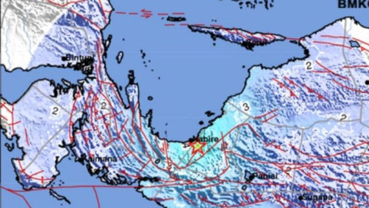


JAYAPURA - General Manager of Witel West Papua Eric M. Tobing stated that the internet network in the Nabire area experienced disruption after the earthquake at a depth of 24 kilometers northwest of Nabire.
"The earthquake at a depth of 24 kilometers northwest of Nabire on Friday caused TelkomGroup services in the Nabire, Botawa and Enarotali areas to experience disruptions," he said in a press release received by Antara in Jayapura, Friday, September 19.
According to Eric, Telkom and the Telecommunications team of East Palapa Telematics (PTT) are currently in the process of accelerating the connection of the Kigamani-Timika route so that services can recover as before in the midst of quite difficult natural conditions, which are caused by landslides on the land FO cable line.
"We apologize for the inconvenience felt by our customers, ask for prayers and support for the smooth recovery process," he said.
SEE ALSO:
-
 | TEKNOLOGI
Tim Cook Hadiri Jamuan Kenegaraan Inggris Bersama Presiden Trump
19 September 2025, 06:05 -
 | LIFESTYLE
Mengapa Masyarakat Jahiliyah Tidak Mempercayai Adanya Hari Kiamat? Ini Sebab-sebabnya
19 September 2025, 04:25

Based on the official website of the Meteorology, Climatology and Geophysics Agency (BMGK), the 6.6 magnitude earthquake rocked Nabire City, Central Papua on Friday at around 01.19 WIB and did not have the potential for a tsunami.
The earthquake that rocked Nabire City was located at the coordinates of 3.47 South Latitude, 135.49 East Longitude. The location is about 29 kilometers northwest of Nabire City with a depth of 24 kilometers.
The English, Chinese, Japanese, Arabic, and French versions are automatically generated by the AI. So there may still be inaccuracies in translating, please always see Indonesian as our main language. (system supported by DigitalSiber.id)
Popular


