


ANKARA - Philippine Institute of Volcanology and Seismology (Phivolcs) said the epicenter was about 98 kilometers east of Sarangani Island with a depth of 10 kilometers.
According to the Manila Times citing Phivolcs, the earthquake was a tectonic earthquake with Intensity V on a Phivolcs scale.
SEE ALSO:

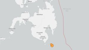
The tremors of the earthquake with Intensity V were felt in Malungon, Saranani, while vibrations with Intensity IV (four) were recorded in Kiamba, Saranani, and Kota General Santos, South Cotabato.
The Manila Times initially reported that the earthquake that rocked the Davao Ocidental area had a magnitude of 6.9.
Previously, a 6.3 magnitude vibration struck off the coast of the Philippines on Tuesday.
Gempa bumi terjadi hampir setiap hari di Filipina karena wilayahnya berada sepanjang "Cincin Api" Pasifik - zona aktivitas seismik intensif yang m
The English, Chinese, Japanese, Arabic, and French versions are automatically generated by the AI. So there may still be inaccuracies in translating, please always see Indonesian as our main language. (system supported by DigitalSiber.id)


