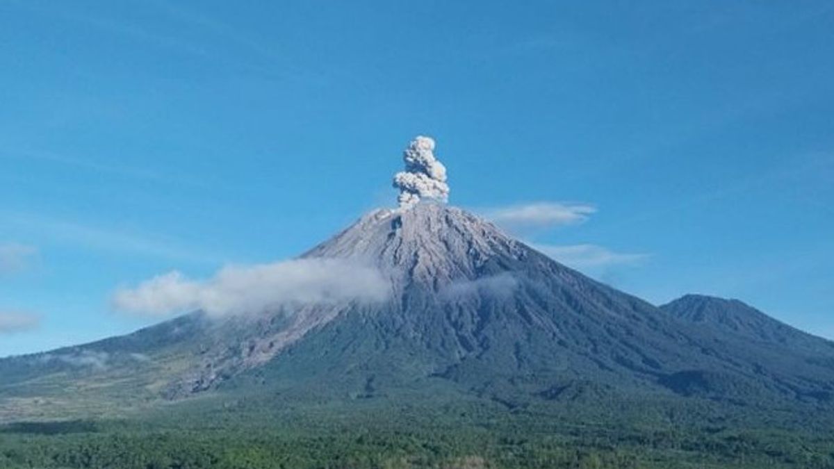


Mount Semeru, which is located on the border of Lumajang and Malang Regencies, East Java (East Java), erupted with an eruption as high as 900 meters above the peak on Wednesday, April 23 morning.
"There was an eruption of Mount Semeru at 06.28 WIB and the height of the eruption column was observed to be about 900 meters above the peak or 4,576 meters above sea level (masl)," said Mount Semeru Observation Post Officer Sigit Rian Alfian, quoted by ANTARA.
According to him, the ash column of Mount Semeru was observed to be gray with thick intensity to the north and the eruption was recorded on a seismograph with a maximum amplitude of 22 mm and a duration of 123 seconds.
Based on officers' records, the activity of Mount Semeru is still dominated by earthquake eruptions on observations of the earthquake on Tuesday (22/4) for 24 hours, namely 35 eruption/eruption earthquakes, two avalanches, five gusts, three deep volcanic earthquakes, and six distant tectonic earthquakes.
He explained that the Center for Volcanology and Geological Hazard Mitigation (PVMBG) provided a number of recommendations related to the status of Mount Semeru which is still Alert or Level II, namely that people are prohibited from carrying out any activities in the southeast sector along Besuk Kobokan as far as eight kilometers from the summit (the center of the eruption).
Then outside of that distance, people are not allowed to carry out activities at a distance of 500 meters from the riverbank (river border) along Besuk Kobokan, because it has the potential to be affected by the expansion of hot clouds and lava flows up to a distance of 13 kilometers from the summit.
SEE ALSO:
-
 | LIFESTYLE
Anya Geraldine Ungkap Persamaan Karakter dalam Film “Mendadak Dangdut”
23 April 2025, 00:10


"People are also not allowed to move within a radius of three kilometers from the crater/peak of Mount Semeru because it is prone to the dangers of incandescent stones," he said.
The public also needs to be aware of the potential for hot clouds, lava avalanches, and rain lava along rivers and valleys that originate at the peak of Mount Semeru, especially along Besuk Kobokan, Besuk Bang, Besuk Kembar, and Besuk Sat, as well as the potential for lava in small rivers that are tributaries from Besuk Kobokan.
The English, Chinese, Japanese, Arabic, and French versions are automatically generated by the AI. So there may still be inaccuracies in translating, please always see Indonesian as our main language. (system supported by DigitalSiber.id)
Most Popular Tags
#Prabowo Subianto #donald trump #Febrie Adriansyah #8791 #giias 2026Popular


