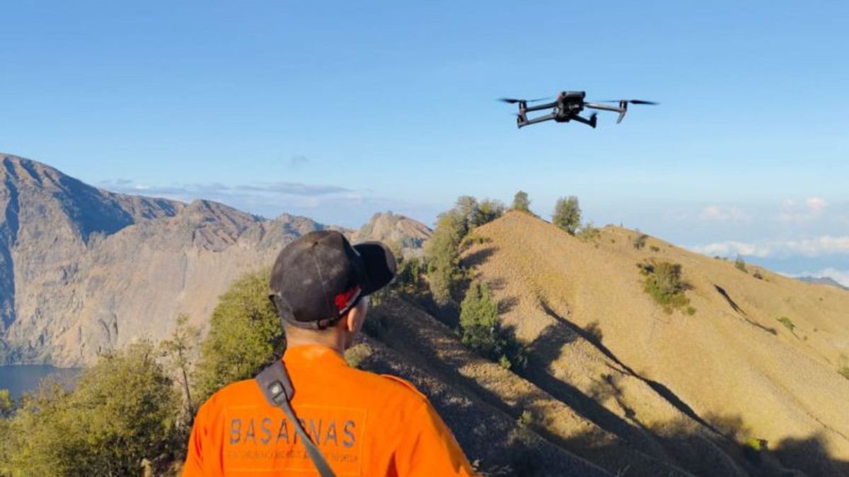
MATARAM - Mount Rinjani National Park Center (TNGR) revealed that the use of small unmanned aircraft or drones can disrupt animal life and disrupt the ecosystem on Mount Rinjani.
"When all the climbers who are now on average 400 people carry all the drones, what will happen to our animals above, the ecosystem can be chaotic," said Head of the Sub-Division of Administration of the TNGR Balai Teguh Rianto in Mataram, Antara, Wednesday, September 18.
Every tourist carrying a drone and entering the Gunung Rinjani National Park area, they are required permission from the TNGR Hall.
On September 17, 2024, Balai TNGR issued an announcement regarding the procedure for using drones in the Mount Rinjani National Park area.
The announcement was in response to conditions on the ground because there was a fairly high interest in the use of drones.
The TNGR Center collects tariffs for non-tax state revenue (PNBP) to tourists who use drones for the purpose of commercial film snapshots as stated in Government Regulation Number 12 of 2014.
The amount of PNBP levies is divided into three categories, namely commercial videos subject to a tariff of Rp. 10 million per package, taking pictures through handycam worth Rp. 1 million per package, and taking photos of Rp. 250 thousand per package.
The regulation applies to all locations within the Mount Rinjani National Park area, especially tourist destinations. The use of drones outside tourist destinations is only for research purposes.
"The problem of levies or not later depends on the purpose because the inhabitants of the area are not just climbers," said Teguh.
He emphasized that Mount Rinjani National Park is a conservation area so that the principles of traveling must use conservation principles.
According to historical records, Mount Rinjani National Park is an animal Wildlife Sanctuary designated by the Governor of the Dutch East Indies in 1941.
On March 6, 1990, during the peak event of the 3rd National Nature Conservation Week in Mataram City, West Nusa Tenggara, the Indonesian Minister of Forestry announced the change to Mount Rinjani National Park.
SEE ALSO:
There are two areas for the management of Mount Rinjani National Park, namely the Conservation Section for Region I of North Lombok with an area of 12,357 hectares (30 percent) and the Conservation Section for Region II of East Lombok covering an area of 22,152 thousand hectares (53 percent).
The Gunung Rinjani National Park area has a basic function as a place to protect the life support system, preservation of plant and animal diversity and its ecosystem, as well as sustainable use of biological natural resources and ecosystems.
The English, Chinese, Japanese, Arabic, and French versions are automatically generated by the AI. So there may still be inaccuracies in translating, please always see Indonesian as our main language. (system supported by DigitalSiber.id)
