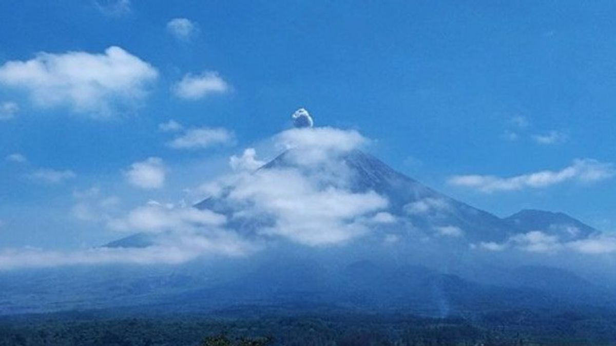


JAKARTA - Mount Semeru, which is located on the border of Lumajang and Malang regencies, East Java, has experienced an eruption 11 times from 06.47 to 18.41 WIB on Sunday.
The first eruption occurred at 06.47 WIB and the eruption visual was not observed, but the eruption was recorded on a seismograph with a maximum amplitude of 22 mm and a duration of 109 seconds.
"Then the eruption erupted again at 09.41 WIB and the visual eruption was not observed," said Mount Semeru Observation Post Officer Sigit Rian Alfian, in a written statement received by Antara in Lumajang.
According to him, the eruption was recorded on a seismograph with a maximum amplitude of 23 mm and a duration of 134 seconds.
The third eruption occurred at 10.51 WIB and the eruption visual was not observed, but this eruption was recorded on a seismograph with a maximum amplitude of 24 mm and a duration of 150 seconds.
The mountain, which has a height of 3,676 meters above sea level, erupted several times until 18:41 WIB. The visual eruption was not observed and when the report was made the eruption was still ongoing.
Sigit explained that the status of Mount Semeru is at Level II or Alert, so that the Center for Volcanology and Geological Hazard Mitigation (PVMBG) provides a number of recommendations, namely that people are prohibited from carrying out any activity in the southeast sector along Besuk Kobokan, as far as eight km from the summit (the center of the eruption).
SEE ALSO:
-
 | BERITA
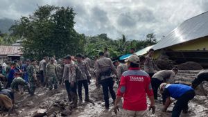
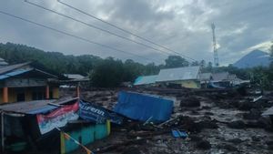
Pencarian Korban Banjir Bandang Ternate Dihentikan Sementara, Dilanjutkan Senin Pagi
25 Agustus 2024, 18:50
Then outside of that distance, people are not allowed to carry out activities at a distance of 500 meters from the riverbank (river border) along Besuk Kobokan, because it has the potential to be affected by the expansion of hot clouds and lava flows up to a distance of 13 kilometers from the summit.
The community is also not allowed to move within a three-kilometer radius of the summit of Mount Semeru because it is prone to the danger of throwing stones (pijar).
In addition, it is necessary to be aware of the potential for hot clouds, lava avalanches, and lahars along rivers that originate at the peak of Mount Semeru, especially along Besuk Kobokan, Besuk Bang, Besuk Kembar, and Besuk Sat, as well as the potential for lahars in small rivers that are tributaries from Besuk Kobokan.
The English, Chinese, Japanese, Arabic, and French versions are automatically generated by the AI. So there may still be inaccuracies in translating, please always see Indonesian as our main language. (system supported by DigitalSiber.id)


