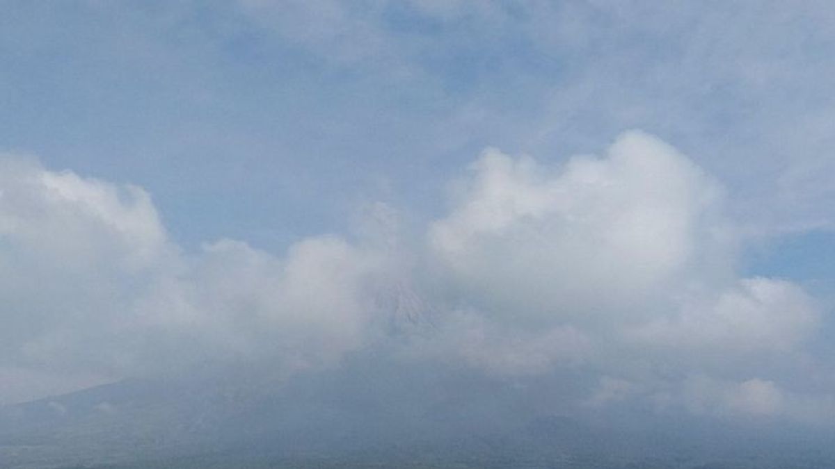


JAKARTA - Mount Semeru on the border of Lumajang Regency with Malang, East Java erupted accompanied by hot clouds.
"The Semeru Monument erupted and the eruption accompanied by hot clouds with an unknown sliding distance because the mountain was covered in fog," said Mount Semeru Observation Post Officer Sigit Rian Alfian as reported by ANTARA, Tuesday, May 21.
According to him, the visual eruption this morning was not observed because it was covered in fog, but the eruption was recorded on a seismograph with a maximum amplitude of 22 mm for 262 seconds.
The highest mountain on the island of Java erupted again at 08.17 WIB with a height of volcanic ash column was observed to be about 800 meters above the peak or 4,476 meters above the peak.
"The ash column was observed to be white to gray with thick intensity to the southwest and west. This eruption was recorded on a seismograph with a maximum amplitude of 22 mm and a duration of 118 seconds," he said.
Previously, Mount Semeru erupted on Monday (20/5) at 19.15 WIB accompanied by hot clouds with an unknown sliding distance due to visually covered in fog. During the eruption, the height of the volcanic ash column of Mount Semeru was not observed and the eruption was recorded on a seismograph with a maximum amplitude of 22 mm and a duration of about 4 minutes 8 seconds.
Meanwhile, the Head of the Lumajang Regional Disaster Management Agency (BPBD) Patria Dwi Hastiadi said the eruption of Mount Semeru, which was accompanied by hot clouds, on Monday (20/5) night and Tuesday morning, was still in the safe category.
"Based on the officer's report, the distance from the hot cloud glide cannot be known because it is covered in fog, but so far it is certain that it is still safe and under control because it is far from residential areas," he said.
SEE ALSO:

Mount Semeru is still on Alert or Level III status, so the Center for Volcanology and Geological Hazard Mitigation (PVMBG) provides recommendations so that people do not carry out any activities in the southeast sector along Besuk Kobokan as far as 13 km from the summit (the center of the eruption).
Beyond this distance, the community is also advised not to carry out activities at a distance of 500 meters from the riverbank (river border) along Besuk Kobokan because it has the potential to be affected by the expansion of hot clouds and lava flows up to a distance of 17 km from the summit.
Residents are also prohibited from doing activities within a five-kilometer radius of the crater/peak of Mount Semeru, because they are prone to the danger of throwing stones (pijar).
The public is also asked to be aware of the potential for hot clouds, lava avalanches, and lahars along rivers/valleys that originate at the peak of the Semeru Volcano, especially along Besuk Kobokan, Besuk Bang, Besuk Kembar, and Besuk Sat, as well as the potential for lahars in small rivers that are tributaries of Besuk Kobokan.
The English, Chinese, Japanese, Arabic, and French versions are automatically generated by the AI. So there may still be inaccuracies in translating, please always see Indonesian as our main language. (system supported by DigitalSiber.id)


