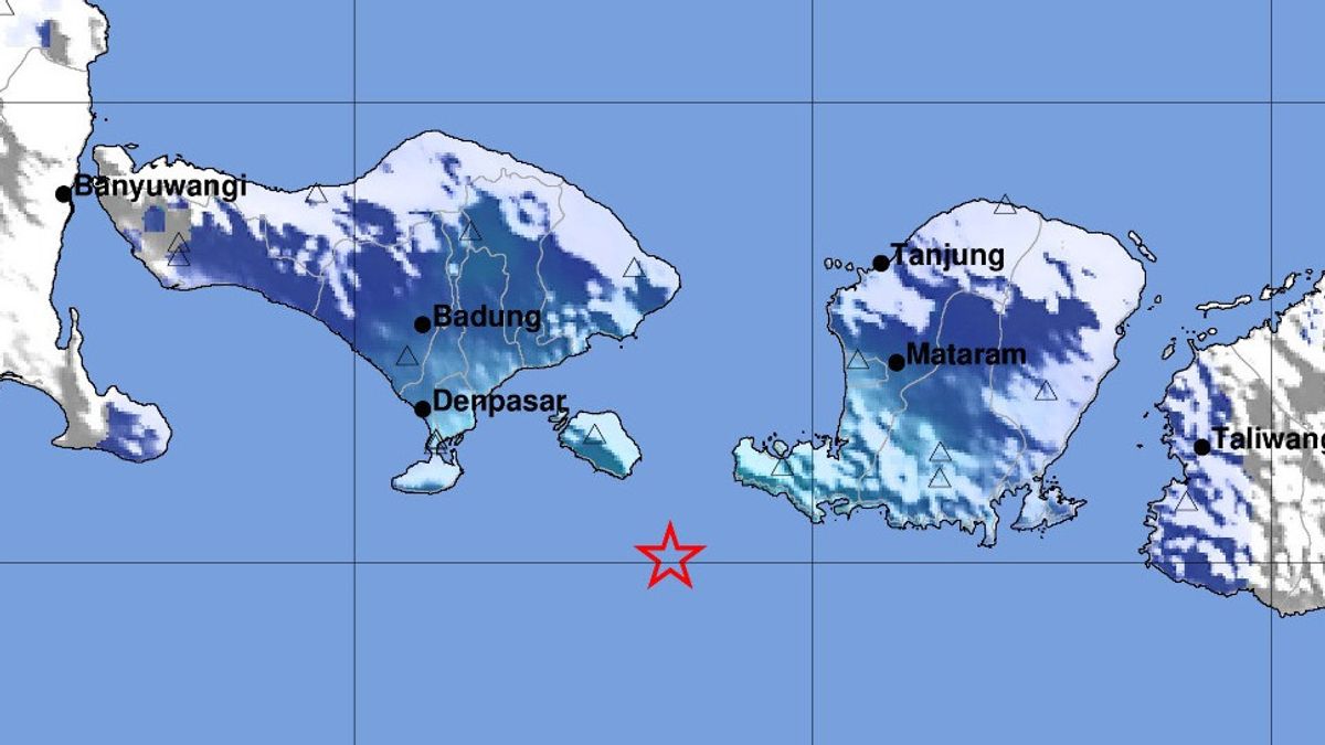


DENPASAR - An earthquake in South Kuta Bali was felt by the tremors to Lombok, West Nusa Tenggara (NTB). This Bali earthquake had a magnitude of 4.8.
"The results of the BMKG analysis show that this earthquake has a magnitude of M=4.8, located at sea at a distance of 55 km southeast of South Kuta, Bali, at a depth of 101 km," said Head of the Center for Meteorology, Climatology and Geophysics (BMKG) Region III Denpasar, Bali, Cahyo Nugroho, Thursday, January 25.
Gempa Bali merupakan jenis gempa bumi menengah akibat adanya aktivitas subduksi lempeng Indo-Australia di bawah lempeng Eurasia. Hasil analisis mekanisme sumur menunjukkan gempa bumi memiliki mekanisme pergerak dengan kombinasi mendatar atau oblique thrust fault.
Meanwhile, the impact of the earthquake was based on community reports in the form of shocks felt in the Mataram City area, East Lombok, West Lombok, Central Lombok.
SEE ALSO:
-
 | BERITA
KPK Ingatkan Bansos Tak Boleh Disusupi Kepentingan Pilpres dengan Foto/Stiker Calon
25 Januari 2024, 21:21 -
 | BERITA
KPU Pastikan Teknis Debat Final Capres Masih Sama, Penonton Tetap Ada
25 Januari 2024, 21:09


Then, in the areas of Kuta, South Kuta, Tabanan, Klungkung, Bangli, Gianyar, Karangasem, Denpasar, several people felt the vibration.
Furthermore, in the North Lombok area, West Sumbawa vibrations were also felt.
"Until now, there have been no reports of damage caused by the earthquake. The results of tsunami modeling with tectonic earthquake sources show that this earthquake has no potential for a tsunami," he explained.
The English, Chinese, Japanese, Arabic, and French versions are automatically generated by the AI. So there may still be inaccuracies in translating, please always see Indonesian as our main language. (system supported by DigitalSiber.id)


