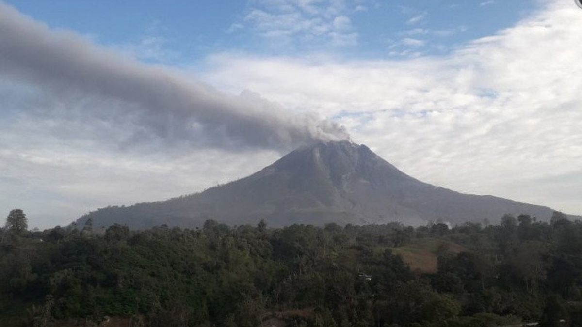
MEDAN - Ashes of Mount Sinabung in Karo Regency, North Sumatra, were observed with a glide distance of 500-1,000 meters to the east, southeast, and south.
"The ash fall was clearly visible," said the Acting Head of the Karo Regional Disaster Management Agency, Natanail Warin-angin, quoted by Antara, Thursday, February 18.
He said smoke from the weak to strong pressure crater was observed to be white with a thick intensity and 200-700 meters high above the crater peak.
"The weather was sunny and cloudy, the wind was blowing weakly to the west and northwest. The temperature was 21-26 degrees Celsius. The number of avalanches was 30, amplitude 2-100 mm, and duration 17-175 seconds," he said.
Currently, Mount Sinabung, whose altitude reaches 2,460 meters above sea level (masl) is at Level III (Alert) status. Residents and farmers are recommended not to carry out activities in the villages that have been relocated as well as in locations within a three kilometer radius from the top of the mountain.
In addition, the sectoral radius is five kilometers for the south-east sector and four kilometers for the east-north sector.
"If ash rains, people are advised to wear masks when leaving the house to reduce the health effects of volcanic ash," he said.
Natanail asked the community to secure clean water facilities and clean the roofs of houses from thick volcanic ash so that they do not collapse.
"People who live near the rivers that head up on Mount Sinabung are also asked to remain alert to the dangers of lava," he added.
The English, Chinese, Japanese, Arabic, and French versions are automatically generated by the AI. So there may still be inaccuracies in translating, please always see Indonesian as our main language. (system supported by DigitalSiber.id)


