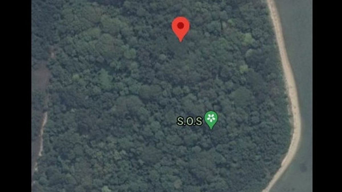
JAKARTA - The police will coordinate with Google regarding the appearance of the SOS sign on the Google Maps application. This is done to explore the causes of these signs.
"That's why we asked for confirmation from Googler, what is the mechanism for including things like that," said Head of the Thousand Islands Police, AKBP Eko Wahyu Fredian, to reporters, Wednesday, January 20.
Meanwhile, based on the results of the investigation by Basarnas and the joint TNI-Polri team, said Eko, there were no signs of victims of the Sriwijaya Air SJ-182 crash. In fact, tracing was carried out to several islands in the vicinity of these coordinates.
"Basarnas itself from the beginning of the incident the ship was attached to Male Island because it is close to it. So it is not only Male Island, all the other islands have been (traced) up to now," said Eko.
Previously, the Google Maps screenshot from the SOS point was widely shared by netizens on Twitter, Instagram and TikTok. They linked it to the possibility of survivors from the Sriwijaya Air SJ-182 incident which fell on January 9.
Basarnas Director of Operations, Brigadier General Rasman, said that he had ordered his members to look for these signs. However, the results did not find any signs of needing any help on Male Island.
"This morning I told the members to check. I have confirmed to the members, they did not find anything," said Rasman.
The English, Chinese, Japanese, Arabic, and French versions are automatically generated by the AI. So there may still be inaccuracies in translating, please always see Indonesian as our main language. (system supported by DigitalSiber.id)


