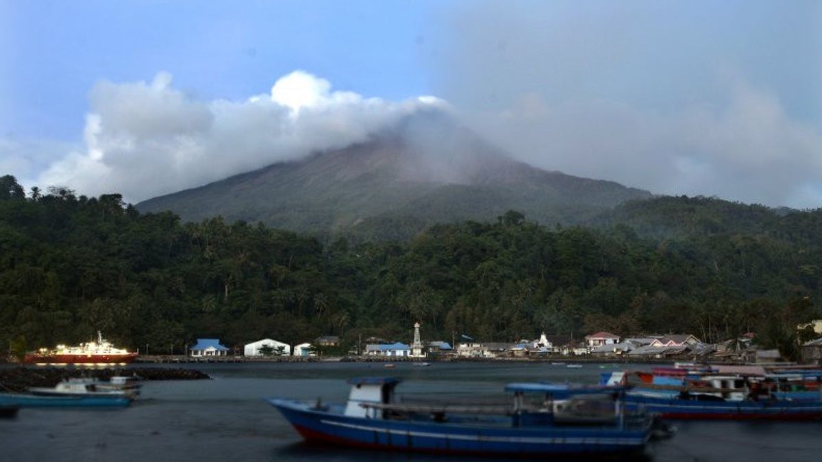


The Center for Volcanology and Geological Hazard Mitigation (PVMBG) has asked residents to be aware of the potential for lava flooding that flows down the crater peak of Mount Karangetang on Siau Island, North Sulawesi Province (Sulut).
The Coordinator of the PVMBG Volcano of the Oktory Prambada Geological Agency said Mount Karangetang has four lava parameters, namely piles of volcanic material, valleys, slope, and rain.
"The four factors are all on Mount Karangetang. So, other possible dangers in the form of floods or lahars," he said at a press conference monitored in Jakarta, Thursday, February 9, was confiscated by Antara.
Oktory said Mount Karangetang has a steep slope, so that if water and piles of volcanic material mix can cause lahars to fall quickly. People are sometimes not aware of the existence of lahars passing through rivers in the area.
"Some rivers passed by lava so quickly and a few days immediately disappeared due to its high slope. So it's not like the lava floods we've seen in Semeru or Merapi," said Oktory.
PVMBG appealed to residents living along the riverbanks that originate from the peak of Mount Karangetang to be aware of the secondary danger in the form of the threat of lava flow during the rainy season.
On February 8, 2023, at 16.00 WIB or 17.00 WITA, the Geological Agency officially raised the status of Mount Karangetang from level II or Alert to level III or Alert.
The decision to increase the disaster status is based on the results of the evaluation of volcanic activity visually and with seismicity which shows an increase in activity.
Currently, Mount Karangetang is the most active volcano in Indonesia with frequent eruptions almost every year. The characteristic eruption is in the form of explosive strombolian eruptions and the growth of lava domes that are often followed by lava avalanches.
The danger of Mount Karangetang is generally caused by lava avalanches from the lava dome and secondary hazards in the form of lava. The risk of danger is getting higher because the area around Mount Karangetang has a distance between the coastal boundary and the eruption center is only about four kilometers and within that area there are also many settlements.
Since 2000 until now, thermal anomaly data has recorded 1.237 hotspots on Mount Karangetang. The accumulation of magma volume issued is 145 million cubic meters or about 21,000 cubic meters per day.
Meanwhile, since November 24, 2018 until now, thermal satellites are still recording 107 hotspots on the volcano. The accumulation of magma volume issued reaches 7 million cubic meters.
"Referring to the potential danger of the current eruption of Mount Karangetang, it is advised not to carry out activities at a radius of 2.5 kilometers from the main crater and the expansion of sectoral to the south and southeast as far as 3.5 kilometers," concluded Oktory.
The English, Chinese, Japanese, Arabic, and French versions are automatically generated by the AI. So there may still be inaccuracies in translating, please always see Indonesian as our main language. (system supported by DigitalSiber.id)


