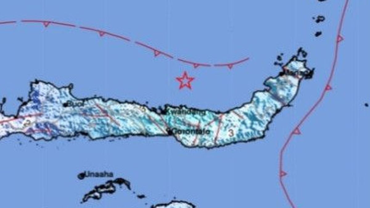


JAKARTA - The Meteorology, Climatology and Geophysics Agency (BMKG) informed that the earthquake had a magnitude of 5.4 on Saturday, November 12, at 18.01 WIB shook North Gorontalo.Plt. Head of the BMKG Earthquake and Tsunami Center, Daryono in Jakarta, Saturday said that the epicenter was in the sea 48 kilometers northwest of Boroko Bolaang Mongondow Utara. "The earthquake is precisely located at coordinates 1.35 North Latitude (LU) and 123.26 East Longitude (BT) with a depth of 10 kilometers," he explained, quoted by Antara.
Based on the estimation of the shock map (shakemap), it was conveyed that this earthquake caused shocks in the areas of Gorontalo City and North Gorontalo with an intensity scale of III MMI or vibrations felt real in the house, vibrations felt as if a truck was passing. Then, vibrations were also felt in the Gorontalo Regency area with an intensity scale of II - III MMI (vibrationality felt real in the house, felt vibration as if a truck was passing). Meanwhile in Pohuwato with an intensity scale of II MMI (vibrationality felt by several people, light objects that were hung swayed).
The English, Chinese, Japanese, Arabic, and French versions are automatically generated by the AI. So there may still be inaccuracies in translating, please always see Indonesian as our main language. (system supported by DigitalSiber.id)


