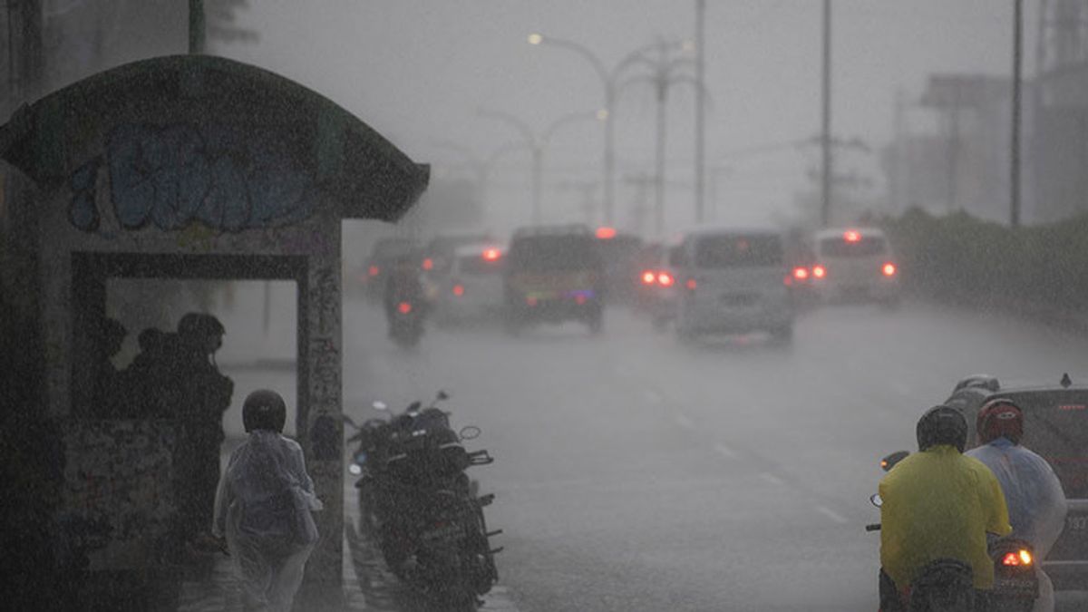


CILACAP - The Meteorology, Climatology and Geophysics Agency (BMKG) urges people in parts of Central Java, especially the central mountains of Central Java and the western part of Central Java to be aware of the potential for extreme weather to occur on July 22-23 2022. Ahmad Yani Semarang this afternoon July 21, extreme weather has the potential to occur in the central mountainous region of Central Java which includes Purbalingga, Banjarnegara, Wonosobo, and surrounding districts on July 22, 2022," said Head of the BMKG Technician Group Stamet Tunggul Wulung Cilacap Teguh Wardoyo in Cilacap, Central Java. , Thursday, July 21. Meanwhile, on July 23, 2022, he said, extreme weather has the potential to occur in the western region of Central Java which includes Cilacap, Brebes, Banyumas, Purbalingga, and surrounding districts. According to him, the potential for extreme weather is in the form of moderate-intensity rainfall. to heavy rain which can be accompanied by lightning and strong winds.."Forecast of potential weather "This extreme condition is based on the analysis of atmospheric dynamics and sea surface temperature anomalies in the Indian Ocean south of Java and the Java Sea which can increase the potential for rain cloud growth in several areas," he said, quoted by Antara. contribute to the formation of rain clouds in parts of Indonesia.
In this regard, Teguh appealed to the public to remain alert to the potential for extreme weather on 22-23 July 2022 which has the potential to cause hydrometeorological disasters in the form of floods, flash floods, landslides, strong winds, and tornadoes, especially for people who live and live. in areas prone to hydrometeorological disasters. Furthermore, he said BMKG Stamet Tunggul Wulung Cilacap on Thursday (21/7) again issued an early warning of high waves in the southern seas of West Java, Central Java, and the Special Region of Yogyakarta which is valid until Friday (22/02). 7). In this case, the wave height of 2.5-4 meters which is categorized as high has the potential to occur in the southern waters of Sukabumi, southern waters of Cianjur, southern waters of Garut, southern waters of Tasikmalaya, southern waters of Pangandaran, southern waters of Cilacap, southern waters of Kebumen, the southern waters of Purworejo, and the southern waters of Yogyakarta. In addition, high waves (2.5-4 meters, ed.) The potential occurs in the Indian Ocean south of Cilacap, the Indian Ocean south of Kebumen, the Indian Ocean south of Purworejo, and the Indian Ocean south of Yogyakarta. Meanwhile in the Indian Ocean south of Sukabumi, the Indian Ocean south of Cianjur, the Indian Ocean south of Garut, the Indian Ocean south of Tasikmalaya, and the Southern Indian Ocean Pangandaran has the potential for very high waves ranging from 4-6 meters. "The increase in wave height is influenced by wind patterns in the southern part of Indonesia, which predominantly move from east to southeast with wind speeds ranging from 5-25 knots," said Teguh. The highest wind speeds were observed in the western and southern parts of the Sunda Strait, the southern waters of Banten, the Java Sea, the Banda Sea, and the Arafuru Sea. the possibility of a high wave."We will inform you soon Tell all marine service users and the public if there are further developments related to wave conditions," said Teguh Wardoyo.
The English, Chinese, Japanese, Arabic, and French versions are automatically generated by the AI. So there may still be inaccuracies in translating, please always see Indonesian as our main language. (system supported by DigitalSiber.id)
Most Popular Tags
#Prabowo Subianto #donald trump #2026 World Cup #venezuela #konflik timur tengahPopular


