

KENDARI - The Meteorology, Climatology and Geophysics Agency (BMKG) of Southeast Sulawesi predicts the potential for increased rainfall and wave height during the 2022 Eid backflow.
Head of the Class II Kendari Maritime Meteorology Station, Sugeng Widarko, reminded residents and travelers on the road to be alert to the potential for extreme weather during the next week.
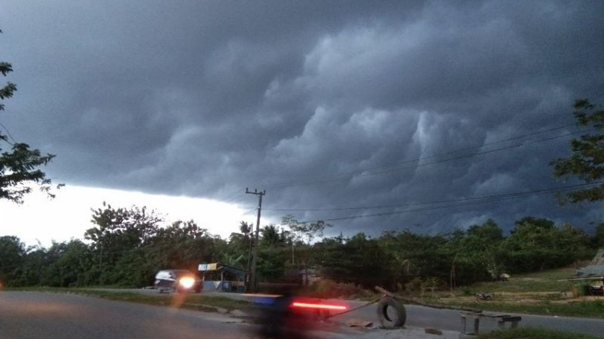
"The BMKG appeals to the public to remain vigilant in particular about the impact of high rainfall that can trigger hydrometeorological disasters such as floods, landslides, flash floods, puddles, strong winds, fallen trees and slippery roads," he said in Kendari, quoted by Antara, Friday. May 6th.
The Southeast Sulawesi BMKG predicts that in the next few days the potential for extreme weather, moderate to heavy rainfall that can be accompanied by lightning, lightning and strong winds has the potential to occur.
He explained that this condition was triggered by an increase in atmospheric dynamics activity, such as low pressure in the north of Sulawesi
At the same time, Sugeng continued, the SOI and ENSO indices were significant and the low-lying wet air mass was concentrated in the Southeast Sulawesi region up to the 700 mb layer reaching 70-90 percent, the lability index was mild to moderate and local scale convective patterns in the Southeast Sulawesi region.
In addition, warm sea surface temperatures in the area around Southeast Sulawesi, especially parts of the Baubau, Wakatobi and Banda Sea waters, thus increasing the supply of water vapor which is high enough to support the formation of high enough rain clouds in the Southeast Sulawesi region.
"Based on the observation of wind movements or streamlines, it is observed that wind movements from east to south enter the Banda Sea, East Sulawesi, Wakatobi waters, to Baubau waters with wind speeds of more than 20 knots," he said.
He said the potential for extreme weather on May 6, 2022 could occur in Konawe, Muna, South Konawe, East Kolaka, North Buton, West Muna and Wakatobi Regencies.
Furthermore, on May 7, the potential for extreme weather could occur in Wakatobi Regency, East Kolaka, Konawe Islands, North Konawe, South Buton, South Konawe, Kolaka and Kendari City.
Next on May 8, it could occur in the districts of Kolaka, South Konawe, Konawe, Central Buton, South Buton, Wakatobi, West Muna, North Kolaka, Kendari City and Baubau.
A day later on May 9, the potential for extreme weather could occur in the districts of Konawe, Kolaka, South Konawe, Kendari, North Konawe, Konawe Islands, North Kolaka, Bombana, Muna, East Kolaka, North Kolaka.
Then, the next day, on May 10, the potential for extreme weather could occur in North Kolaka Regency, North Konawe, Wakatobi, Konawe and Kendari City.
"Please pay attention to the risk of high waves on shipping safety and people who live and work on the coast around areas that are prone to high waves in the waters of Manui Kendari, Baubau, Wakatobi, southern Banggai, and the East Banda Sea, Southeast Sulawesi, should always be vigilant, especially starting on December 31, 2020. May 7, 2022," said Sugeng.
The English, Chinese, Japanese, Arabic, and French versions are automatically generated by the AI. So there may still be inaccuracies in translating, please always see Indonesian as our main language. (system supported by DigitalSiber.id)


