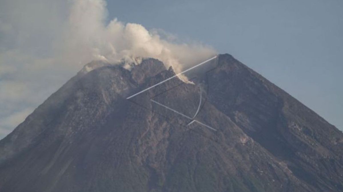
YOGYAKARTA - The lava dome in the center of the crater of Mount Merapi's summit continues to grow with an estimated volume of 3,007,000 cubic meters, according to the Geological Disaster Technology Research and Development Center (BPPTKG).
Head of BPPTKG Hanik Humaida explained that the volume of the lava dome was measured based on the results of morphological analysis of aerial photos taken from the Tunggularum, Ngepos, and Babadan-2 Camera Stations on December 8, 2021.
The volume of the lava dome in the middle of the crater of the peak of Merapi is greater than the volume of the lava dome on the southwest side of the mountain which reaches 1,629,000 cubic meters.
"The volume of the southwest lava dome is 1,629,000 cubic meters and the middle dome is 3,007,000 cubic meters," said Hanik, quoted by Antara, Friday, December 10.
Compared to the BPPTKG report for the period November 26 - December 2 2021, the volume of the central lava dome of Merapi is still at 2,948,000 cubic meters and the southwest dome is recorded at 1,615,000 cubic meters.
Hanik explained that during observations from December 3 to 9, 2021, Merapi threw hot clouds of avalanches four times with a maximum glide distance of 2,200 meters towards the Bebeng River.
The active volcano has also recorded 190 lava avalanches with an estimated maximum sliding distance of 2,000 meters to the southwest and Bebeng River.
The seismic activity of Mount Merapi was recorded as 4 times hot cloud earthquake (AP), 8 times Shallow Volcanic earthquake (VTB), 55 times Multi-phase earthquake (MP), 1,020 times Abortion earthquake (RF), 25 times gust earthquake (DG), and 10 times Tectonic earthquake (TT).
"The intensity of the earthquake this week was higher," he said.
Meanwhile, the deformation or changes in the shape of the mountain monitored using EDM this week showed a distance shortening rate of 0.5 cm per day.
This week, BPPTKG also recorded rainfall intensity at the peak of Merapi at 53 mm per hour for 80 minutes based on observations from the Babadan Post on December 9, 2021.
"There was an increase in flow and lahar in the Gendol, Boyong, and Pabelan rivers," said Hanik.
BPPTKG until now maintains the status of Mount Merapi at Level III or Standby.
Residents are asked to be aware of the potential impact of lava flows and hot clouds of Mount Merapi in the south-southwest sector which includes the Yellow, Boyong, Bedog, Krasak, Bebeng, and Putih rivers.
If an eruption occurs, the ejection of volcanic material from Mount Merapi can reach an area within a radius of three kilometers from the top of the mountain, said Hanik Humaida.
The English, Chinese, Japanese, Arabic, and French versions are automatically generated by the AI. So there may still be inaccuracies in translating, please always see Indonesian as our main language. (system supported by DigitalSiber.id)


