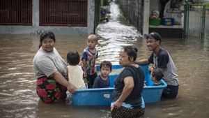


JAKARTA - The polemic of violating Indonesia's maritime boundaries is not new. As the largest archipelagic state (archipelagic state) in the world, maritime boundary violations occur in Sabang to Merauke. China's encroachment on the Natuna Sea waters, for example. The potential wealth of the Natuna seas – natural gas and fish – is the reason.
In addition, we know Natuna is an international sea route. Because of this, China often claims its Natuna territory. At least until today. Indonesia's status as an archipelagic country has not changed since long ago. This advantage gives Indonesia the right to use and manage its marine area of 5.8 million km².
Likewise, all the maritime economic potential contained in it should be utilized optimally by Indonesia. However, the status of an archipelagic country is too small for Indonesia, which has a larger number of oceans than land. In fact, Indonesia has great potential to rise to the level of becoming a maritime country.
A country that is able to be self-sufficient takes advantage of all the potential that the ocean can provide. One of these potentials is present in the Natuna Islands with abundant marine products and gas reserves.
“Nevertheless, there are differences between archipelagic countries and maritime countries. An archipelagic state is a characteristic of a country which geographically consists of many islands that are bound in a single state because they are united by the sea.
"Meanwhile, a maritime country is a country that uses and controls all of its national strategic strengths, in the oceans as a marine power supported by maritime forces such as trading fleets, fishing fleets, maritime industries and services, infrastructure and potential of other marine resources as well as naval power as a reliable war fleet," wrote Lisbet in the book Indonesian Diplomacy and Maritime Connectivity Development (2018).

Natuna's marine potential is no joke. Since the first Natuna marine fish have attracted other countries because of the potential for large profits to be obtained. However, it is impossible to feel the benefits because Indonesia is the rightful owner of the Natuna sea area.
Launching the official website of the Indonesian Ministry of Maritime Affairs and Fisheries, potential capture fisheries commodities in Natuna Regency are divided into two categories, namely pelagic fish and demersal fish. The number of Natuna marine fish that can be caught can reach 400-500 thousand tons per year. The potential for natural gas reserves is the same.
It is said that natural gas in Natuna is the largest in Asia Pacific, and even in the world. That's just from the potential of marine products and natural gas reserves. Not to mention Natuna's potential in politics and defense-security.
"Meanwhile, from a political perspective, the Natuna Islands have an important meaning in Indonesia's maritime diplomacy. The existence of the Natuna Islands makes Indonesia's territorial waters very wide which divides the Malay Peninsula and Sarawak.
"The loss of the Natuna Islands territory will result in the loss of Indonesia's vast marine territory. In the context of defense and security, the Natuna Islands are Indonesia's foremost archipelago in the dynamic constellation of the South China Sea conflict," said Rodon Pedrason et al in the book Management of Maritime Border Defense of the Natuna Islands ( 2021).
The beginning of the Natuna conflict
The potential of Natuna's wealth is the reason for the many thefts and violations committed by other countries. China is one of them. China's ambition to control Natuna has emerged since the 1990s. This ambition has strengthened since 2009. China is trying to make a historical claim on Natuna. The claim identifies the Natuna territory as a legal part of China.
"According to the Chinese version, they included the Natuna area in their regional map based on nine points of an imaginary line commonly called the Nine dash line which has been claimed by China and marked its maritime borders."
“However, from these nine points on the line, Indonesia does not recognize it because according to Indonesia it does not have any international legal basis. The nine imaginary points themselves are one of the causes for the emergence of conflicts in the South China Sea region,” said Rani Purwani Ramli et al in writing in the Hasanuddin International Relations Journal entitled Dispute of the Republic of Indonesia – People's Republic of China in Natuna Waters (2021).
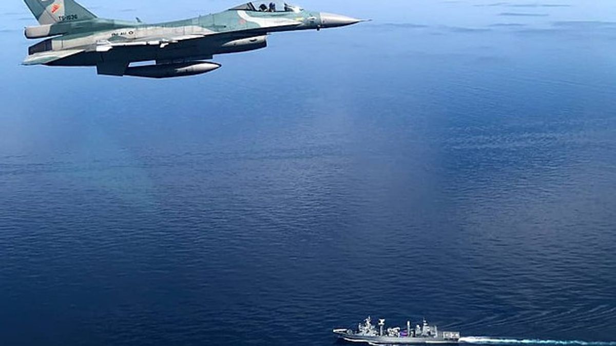
China's claims have troubled Indonesia. Several times the Indonesian-Chinese warships clashed in the Natuna waters. China's courage was allegedly due to the strong desire of China to control Natuna. Moreover, China often issues ambiguous statements that Natuna is indeed within Indonesian territory. However, China did not say that Natuna is an integral part of Indonesia's possession.

China's actions to disrupt activities in the Natuna waters continue. In 2019, the Chinese fisherman and his government's official authorities were monitored intensively into the Natuna area. In fact, the international court through the United Nations Convention of the Law of the Sea (UNCLOS) has determined that China's "Nine Dash Line" which has existed since 1947 does not have a strong historical basis.
Based on the 1982 UNCLOS, Indonesia's foreign policy stance is firm. The government rejects the claim of the Exclusive Economic Zone (EEZ) in the Natuna Sea and South China Sea areas. In addition, the decision of the United Nations (UN) arbitral tribunal regarding the claims of countries in the South China Sea also strengthens Indonesia's determination regarding the territory and sovereignty of the country's seas.
"Indonesia's stance is based on the 1982 UNCLOS which applies internationally and is also in accordance with the results of the International Court of Justice in 2016 so that Indonesia's negotiating partners cannot use small islands as EEZ projections and the continental shelf. In this case, Indonesia only claims the islands that have long been its sovereign territory, namely Natuna and Anambas.” Close Syarifurohmat Pratama Santoso in the book Geopolitics of the South China Sea Region (2021).
*Read other information about the HISTORY of the NUSANTARA or read other interesting writings from Yudhistira Mahabharata.
Other MEMORIESThe English, Chinese, Japanese, Arabic, and French versions are automatically generated by the AI. So there may still be inaccuracies in translating, please always see Indonesian as our main language. (system supported by DigitalSiber.id)

Related News