

JAKARTA - The infiltration of water into the soil cavity is suspected to be the initial cause of the cliff landslide in Pondok Balik Village, Ketol District, Central Aceh Regency, Aceh.
The flow of water made the cavity under the ground surface widen and triggered the progressive movement of the soil.
The Minister of Public Works (PU) Dody Hanggodo has also directly reviewed the progress of handling the landslide on Monday, March 9.
The review was carried out as a follow-up to the previous visit in February 2026, as well as following up on President Prabowo Subianto's direction that disaster handling be carried out comprehensively and integrated.
Based on field monitoring, the length of the road body affected by the landslide now reaches around 175 meters.
The previous landslide had been progressing by about four meters per day due to the flow of water entering the soil cavity below the surface.
"Initially there was water seepage below which made the hole widen. Even before it had grown to about four meters per day. Now we see it has decreased a lot because the channel leading to the hole has started to dry up," said Dody as quoted from a written statement, Wednesday, March 11.
According to Dody, the government continues to take technical steps to stop the development of landslides by controlling the flow of water which is one of the main causes of collapse.
"There are already several works being carried out by friends based on technical studies with a team of experts from ITB and Unsyiah. There was also input from the Regent of Bener Meriah who asked the team to review it again, one of which is the possibility of building a pond," he said.
As the landslide progressed, the junction to the first detour road was eroded, so the road could no longer be used.
Currently, public mobility is diverted through two other alternative routes, namely the second detour along about 2.2 kilometers and the third detour along about 5.3 kilometers.
On both lanes, temporary handling in the form of road body and pavement repair using sirtu material has been carried out, so that it can be passed by two-wheeled and four-wheeled vehicles.
To strengthen the technical study, the PU Ministry also conducted various field data collection, including Lidar surveys, borelog drilling at two points, geoelectric surveys on five tracks, georadar and visual observations to map the geological conditions of the area in more detail.
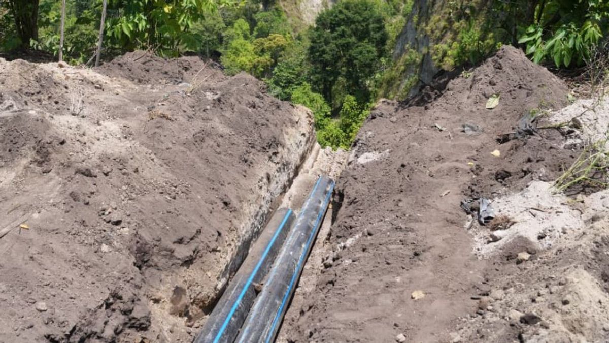
In addition, the Aceh National Road Implementation Center (BPJN) together with the Aceh Provincial Natural Disaster Handling Acceleration Task Force of the Ministry of PU also coordinated with the Central Aceh Regency Government (Pemkab) and Bener Meriah Regency Government to relocate irrigation canals to stay away from the landslide area.
Dody emphasized that safety was the top priority in handling the landslide.
Therefore, the PU Ministry is currently focusing on efforts to stabilize conditions around the location before permanent reinforcement is carried out.
"The most important thing now is to ensure that the conditions around the landslide are really stable and safe. We can't force work at the point of the hole if there is still a potential for movement. Therefore, our current focus is to reduce the flow of water and strengthen the slope first, then permanent handling will be carried out so that the landslide does not spread again," he added.
The English, Chinese, Japanese, Arabic, and French versions are automatically generated by the AI. So there may still be inaccuracies in translating, please always see Indonesian as our main language. (system supported by DigitalSiber.id)
Most Popular Tags
#Prabowo Subianto #donald trump #2026 World Cup #Febrie Adriansyah #8791Popular


