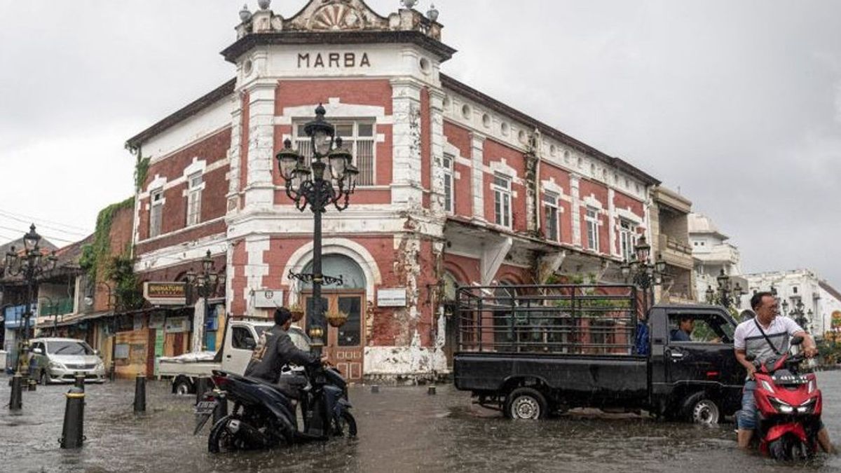


JAKARTA - The floods that hit Semarang City, Central Java since December 31, 2022 had paralyzed community activities. Protocol roads such as Kaligawe, Mangkang, Kota Lama, and Simpang Lima areas were submerged with water levels ranging from 30-50 centimeters.
The condition has not fully recovered to date. A number of areas such as the Trimulyo area, Genuk, on Wednesday (4/1) were still submerged with water levels of more than 30 centimeters at several points.
Likewise in Jakarta. Heavy rains that flushed on January 1 also caused 15 roads, especially in the North Jakarta area to be inundated. The flood may continue due to the tidal wave.
The DKI Jakarta Regional Disaster Management Agency (BPBD) appealed to people on the coast to always be vigilant and alert to anticipate the impact of the maximum tide of sea water in the next few days.
"Based on the BMKG press release regarding the potential warning of coastal flooding (rob) on January 3-10, 2023, there is a full moon phenomenon on January 6, 2023, which has the potential to increase the maximum sea level," wrote @bpbddkijakarta on January 2.
Semarang and Jakarta are two cities that have many geographical similarities. Apart from being on the coast, according to urban planning observers from Trisakti University, Nirwono Yoga, both of them were also passed by many rivers.
The city of Semarang was passed by 9 rivers, namely the Garang River (West Canal), Semarang River, East Canal River, Sringin River, Plumbon River, Karanganyar River, Bringin River, Cilandak River, and Siangker River.
The city of Jakarta was passed by 13 rivers, namely the Ciliwung, Angke, Pesanggrahan, Grogol, Krukut, Baru Barat, Mookevart, Baru Timur, Cipinang, Sunter, Buaran, Jati Kramat, and Cakung rivers.
In addition, the two cities also experienced land subsidence. Semarang averages 4-6 centimeters per year, while Jakarta can be 8-24 centimeters per year due to a larger development burden.
So, in general, the causes of flooding are not much different. The river is both experiencing silting, reduced capacity until the water overflows in the vicinity. Drainage channels are also limited, unable to accommodate high rainfall. In the end, it is prone to flooding, not to mention if the sea water experiences high tides," Nirwono explained to VOI, Wednesday (4/1).
Likewise historically. Floods in Semarang and Jakarta have occurred since colonial times. Based on Van Bemmelen's records, the Dutch East Indies government has made various efforts to prevent flooding, including the river canalization mega project in 1875. This flood prevention project ran for four years.
Van Bemmelen is a Dutch geologist who conducted many early surveys of volcanicism and tectonicism in Indonesia during colonial times. As it turned out, this step did not work effectively in line with the deforestation of forests that were often carried out by the invaders.
It was noted that Semarang had experienced several major floods, including in 1922, on January 10, 1963, January 22, 1976, January 25, 1990, and December 25, 2006.
Meanwhile, in Batavia (in early Jakarta), large floods occurred in 1621. To be precise, three years after the Vereligde Oost-Indische Compagnie (VOC) arrived in Batavia. The company immediately built a canal in the city. The canal excavation has been documented since the fifth century in the Tugu inscription.
Experts assess, not only to deal with flooding, canal excavation is also a means of transportation for residents of European descent. More than five canals have been built since the VOC seized control of Batavia in 30 years. This step also has no major impact in overcoming flooding.
Even so, Nirwono believes that the strong commitment to flooding in Semarang and Jakarta can be resolved. Of course it takes a lot of money.
There are a number of things that can be done, including increasing Green Open Space (RTH) by conserving protected forests as water catchment areas, and revitalizing lakes or reservoirs as water catchment areas.
"Not only to overcome flooding, the existence of green open space can also be a forum for interacting and improving the quality of life of the city community," said Nirwono.
The next step, river regeneration and drainage, as well as restoring coastal areas and deforestation of mangrove forests to complement the existence of embankments.
The rehabilitation of all drainage is carried out by increasing the existing dimension, for example from 50cm to 1.5m, 1m to 3m, 1.5m to 5m and connecting to it, lakes, reservoirs, reservoirs, and nearest green open space, continued Nirwono.
Also noted, many drainages built by housing developers are not connected to premium, secondary, and tertiary drainage.
The primary channel is the river, the secondary is a water channel on the road or river connecting, while the tertiary is a channel that comes from the neighborhood where people live.
"Drainage channels must also be routinely maintained so that they are free from waste, waste, and mud, as well as reorganized separate and integrated utility networks with sidewalk revitalization," added Nirwono.
The English, Chinese, Japanese, Arabic, and French versions are automatically generated by the AI. So there may still be inaccuracies in translating, please always see Indonesian as our main language. (system supported by DigitalSiber.id)


