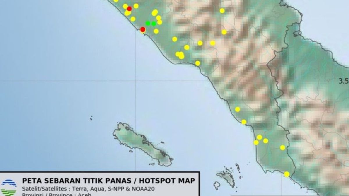


JAKARTA - The Meteorology, Climatology and Geophysics Agency (BMKG) said that as many as 23 hotspots of forest and land fires (karhutla) in West Aceh were monitored via satellite until Friday.
"The results of our monitoring through satellite images, the most fire points or hotspots are indeed in the West Aceh Regency area, the rest are spread in Aceh Jaya, Nagan Raya and other areas in the south-west coastal area of Aceh," said BMKG Meulaboh-Nagan Raya Station Praktirawan, Rijal Sains Fikri reported by ANTARA, Friday, January 23.
He said that the 23 fire points consisted of three fire points with fires estimated to have high intensity, 15 fire points with moderate fire intensity, and five fire points with low fire intensity.
Rijal Science Fikri said based on satellite image observations, the worst location of land fires in West Aceh Regency is located in Suak Raya Village, Johan Pahlawan District, the local regency.
The fire in West Aceh is also expected to potentially spread, because currently the area is observed to have no clouds that can trigger rain.
In addition to West Aceh, BMKG also monitors the fire points that are also spread in Aceh Jaya and Ngan Raya Regencies, as well as a number of other regencies/cities in the south west coast of Aceh.
"We are still monitoring the development of the fire point through satellite imagery," said Rijal Science Fikri.
Meanwhile, information received by reporters in West Aceh stated that the area of burned land in the local area had reached more than 50 hectares.
However, the Acting Head of the West Aceh BPBD, Teuku Ronald Nehdiansyah, who was confirmed separately through an online short message channel, has not responded to the confirmation efforts regarding the area of land that is currently on fire.
The English, Chinese, Japanese, Arabic, and French versions are automatically generated by the AI. So there may still be inaccuracies in translating, please always see Indonesian as our main language. (system supported by DigitalSiber.id)
Most Popular Tags
#Prabowo Subianto #donald trump #Febrie Adriansyah #8791 #giias 2026Popular


