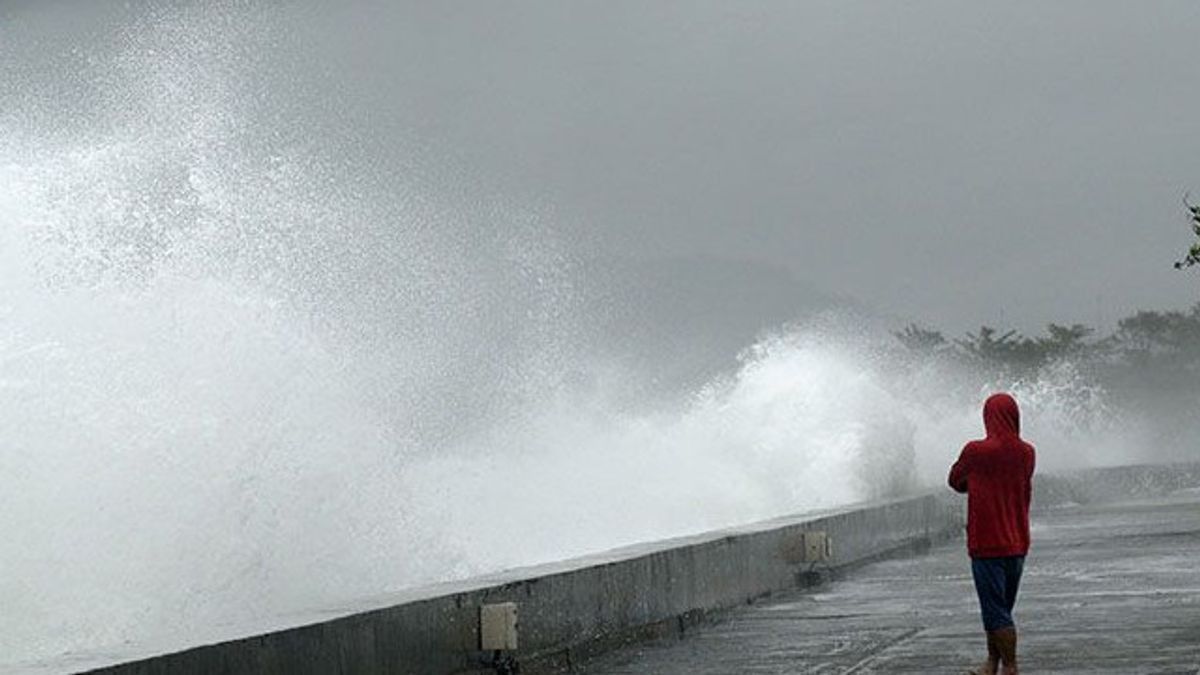


JAKARTA - The Meteorology, Climatology and Geophysics Agency (BMKG) reminded the public to be aware of the potential for hail and high sea waves of up to six meters in a number of areas on Thursday, January 8.
BMKG weather practitioner, Lintang, quoted by Antara, said that the potential for light intensity rain was expected to rain on Banda Aceh, Padang, Bengkulu, Palembang, Pangkal Pinang, Tanjung Pinang, Tanjung Selor, Jambi, Semarang, Jakarta, Bandung, Surabaya, Denpasar, Mataram, Palu, Gorontalo, Manado, Ternate, Ambon, Sorong, Jayawijaya, Kendari, and Merauke.
Moderate rain is potentially in Medan, Serang, Yogyakarta, Palangka Raya, Merauke, and Makassar.
Meanwhile, heavy rain and rain accompanied by lightning are predicted to occur in Pekanbaru City, Bandar Lampung, Pontianak, Banjarmasin, Samarinda, Mamuju, and Kupang.
Furthermore, in Nabire City, and Manokwari, it is estimated that it will be thick clouds to fog.
According to BMKG, the combination of atmospheric dynamics is one of the factors that affect the weather conditions.
Tropical Cyclone Jenna in the waters of the southwest Indian Ocean Banten is estimated to increase to category three in the next two days with wind speeds of 25 knots in category two, forming an area of wind deceleration in the area it passes through.
The BMKG Meteorology Team confirmed that this condition triggered an increase in wind speed and sea wave height in Indonesian waters up to six meters which is estimated to occur in the period of 7 - 10 January 2026.
Wind patterns in the northern part of Indonesia generally move from northwest to northeast with a speed of 6-25 knots, while in the south they move from southwest to northwest with a relatively similar speed.
This condition has the potential to cause waves of 1.25 to 2.5 meters in a number of waters, including the waters of Morotai, Halmahera, Obi, Sanana, Taliabu, Kayoa, Loloda Islands, Batang Dua, Ternate, Bacan, Weda Bay, and the waters of Halmahera and Gebe Islands.
Meanwhile, waves with a height of 2.5 to 4 meters are likely to occur in the Indian Ocean south of West Java, Central Java, East Java, DI Yogyakarta, Bali, NTB, the central and eastern Arafura Sea, and the southern Karimata area north.
Very high waves with a height of 4 to 6 meters are expected to occur in the waters of the North Natuna Sea and are at risk to shipping safety.
The English, Chinese, Japanese, Arabic, and French versions are automatically generated by the AI. So there may still be inaccuracies in translating, please always see Indonesian as our main language. (system supported by DigitalSiber.id)
Most Popular Tags
#Prabowo Subianto #donald trump #Febrie Adriansyah #8791 #giias 2026Popular


