

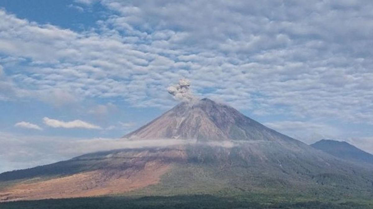


LUMAJANG - The seismic activity of Mount Semeru is still dominated by earthquakes, eruptions or eruptions in recent weeks. The mountain, which is 3,676 meters above sea level (msl), continues to show intense volcanic dynamics.
Mount Semeru Observation Post Officer, Yadi Yuliandi, said based on observations of Monday's tremors, from 00.00-06.00 WIB, 32 volcanic earthquakes were recorded. The earthquake had an amplitude of 10-23 millimeters with a duration of 66-163 seconds.
"In addition, two aftershocks with an amplitude of 2 millimeters and an earthquake duration of 29-45 seconds, and one aftershock with an amplitude of 8 millimeters and a duration of 116 seconds were recorded," said Yadi, quoted from Antara, Monday, January 5.
The highest mountain on Java also experienced two distant tectonic earthquakes with an amplitude of 10-30 millimeters, a S-P time difference of 13-15 seconds, and an earthquake duration of 52-60 seconds.
Meanwhile, during the 24-hour observation period on Sunday (4/1), the seismic activity of Mount Semeru was recorded as quite high, namely 151 times of eruption or eruption earthquakes, 10 times of falling earthquakes, 21 times of breath earthquakes, three times of harmonic earthquakes, and five times of distant tectonic earthquakes.
"Visually, the volcano is clearly visible until it is covered by a level 0-III fog. The main crater smoke is observed to be white to gray with a thin to moderate intensity, with a column height of about 200-300 meters from the peak," explained Yadi.
Currently, the status of Mount Semeru is still at Level III or Alert. In connection with this condition, the Center for Volcanology and Geological Hazard Mitigation (PVMBG) has issued a number of safety recommendations for the public.
The public is prohibited from carrying out any activities in the southeast sector, especially along Besuk Kobokan, as far as 13 kilometers from the peak or the center of the eruption. Outside this distance, residents are also not allowed to carry out activities within a radius of 500 meters from the river banks along Besuk Kobokan because they have the potential to be affected by the expansion of the hot cloud and lava flow up to 17 kilometers from the peak.
In addition, the public is also asked not to carry out activities within a radius of 5 kilometers from the crater or the peak of Mount Semeru, considering the potential danger of incandescent stone throwing.
"The public is urged to remain vigilant against the potential of hot clouds, lava discharge, and lava flows along the river or valley streams upstream of the summit of Mount Semeru," said Yadi.
The areas that need special attention include the Besuk Kobokan, Besuk Bang, Besuk Kembar, and Besuk Sat streams, as well as small rivers that are tributaries of Besuk Kobokan, which have the potential to be passed by lava, especially during rain.
The English, Chinese, Japanese, Arabic, and French versions are automatically generated by the AI. So there may still be inaccuracies in translating, please always see Indonesian as our main language. (system supported by DigitalSiber.id)


