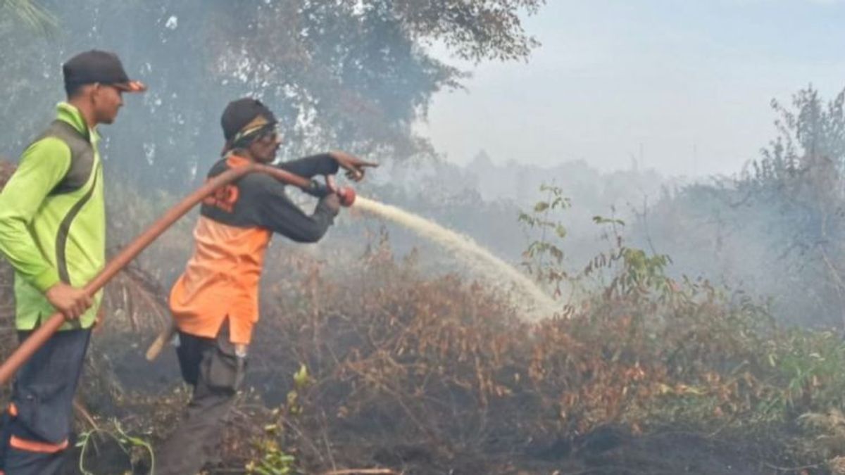


JAKARTA - The Meteorology, Climatology and Geophysics Agency (BMKG) warned that smoke from forest and land fires (karhutla) in Bakongan District, South Aceh Regency, could potentially spread to other districts, namely Gayo Lues and Southeast Aceh.
"If you look at the wind from South Aceh, the wind generally blows to the southwest, namely the Gayo Lues and Southeast Aceh areas," said BMKG Meulaboh-Nigan Raya Station forecaster Yoga Al Ma'ruf on Wednesday, August 27 evening, confiscated by Antara.
Based on satellite imagery observations, he said, the wind surface height reaches 3,000 feet at a speed of 5-25 kilometers per hour.
According to Yoga, forest and land fires usually occur because of the actions of humans who open land by burning or throwing cigarette butts carelessly.
He also appealed to the public to be careful when burning garbage, especially in locations close to peatlands.
Previously, the Aceh Disaster Management Agency (BPBA) reported that forest and land fires in Bakongan had spread to 72 hectares since the disaster occurred on August 19.
"As of the seventh day, approximately 72 hectares of land burned in South Aceh," said BPBA Chief Executive T Nara Setia in Banda Aceh on Tuesday.
The forest and land fires in the sub-district have spread to three villages of Ujong Mangki Village, Padang Beurahan, and Ujung Padang and the cause is still being investigated.
SEE ALSO:
-
 | BERITA
Demo Buruh 28 Agustus, BMKG: Jakarta Berawan, Semarang dan Medan Hujan Ringan
28 Agustus 2025, 06:23 -
 | BERITA
4 Tentara AS Terlibat Kasus Seksual di Pangkalan Militer, Korbannya Sudah Jadi Perwira
28 Agustus 2025, 02:02 -
 | BERITA
Ayah Capres Kolombia yang Tewas Ditembak Umumkan Mencalonkan Diri dalam Pilpres 2026
27 Agustus 2025, 17:02 -
 | BERITA
Jengkel Nelayannya Dibatasi, Rusia Bakal Usir Kapal Penangkap Ikan Norwegia
28 Agustus 2025, 06:04 -
 | BERITA
Kasus Pemerkosaan di Bangladesh Melonjak, Organisasi HAM Kritik Kinerja Polisi
27 Agustus 2025, 18:19
The English, Chinese, Japanese, Arabic, and French versions are automatically generated by the AI. So there may still be inaccuracies in translating, please always see Indonesian as our main language. (system supported by DigitalSiber.id)
Popular


