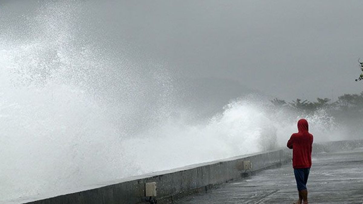


JAKARTA - The Meteorology, Climatology and Geophysics Agency (BMKG) has issued an early warning regarding the possibility of high waves up to 4 meters in several Indonesian waters.
The high wave is predicted to start on Monday, January 20 at 07.00 WIB until Thursday, January 23 at 07.00 WIB.
According to BMKG data, waves with a height of between 2.5 and 4 meters have the potential to hit four territorial waters, namely the western Indian Ocean of Sumatra, the southern Indian Ocean of Banten, the South Indian Ocean of East Java to East Nusa Tenggara (NTT), and the North Natuna Sea.
In addition, the highest wind speed was observed in the northern Natuna Sea and Indian Ocean south of Java to West Nusa Tenggara (NTB).
SEE ALSO:
-
 | TEKNOLOGI
Kekerasan Seksual Anak di Media Sosial Marak, Indonesia Masuk 10 Besar di Dunia
20 Januari 2025, 01:06 -
 | EKONOMI
Layanan Sertifikat dan Tanda Tangan Elektronik di Aplikasi Coretax Gratis
20 Januari 2025, 02:30

Wind patterns in northern Indonesia are dominated by movements from Northeast to East at a speed of 6-30 knots, while in the southern region, winds move from Southwest to Northwest at a speed of 6-30 knots.
BMKG appealed to the public, especially fishermen and those who are active in water areas, to increase awareness of the threat of high waves. Anticipatory steps are very important to reduce the risk of marine accidents due to bad weather and unfavorable water conditions.
The English, Chinese, Japanese, Arabic, and French versions are automatically generated by the AI. So there may still be inaccuracies in translating, please always see Indonesian as our main language. (system supported by DigitalSiber.id)
Most Popular Tags
#Prabowo Subianto #donald trump #Febrie Adriansyah #8791 #giias 2026Popular


