

As many as four early warning systems/EWS or early warning tools for the cold lava flood of Mount Ibu in West Halmahera, North Maluku, are confirmed to function optimally.
"A total of four are equipped with vibration sensors for the lava, lidar sensors, and installed in four river basins that originate from Mount Ibu," said BNPB Director of Systems and Strategy Raditya Jati in a conference on the latest developments after the eruption of Mount Ibu in Jakarta, Wednesday, January 15, which was confiscated by Antara.
He said the EWS, which is complete with vibration sensors and surveillance cameras (CCTV), is the mainstay of cold lava flood mitigation for the local community, and can also be accessed in real time by the public through the BNPB.go.id/gunungbu page.
His party assessed that the existence of the tool was effective in helping inform the local community if there was an increase in the volume of water mixed with lava material left over from the eruption of Mount Ibu, then they were directed to evacuate themselves.
"Including the current conditions, along with the increase in the status of Mount Ibu's activities to Alert and the potential for rain at the top of the volcano, (the device) can be additional information for the Geological Agency team in providing recommendations for what needs to be done for the community," he added.
SEE ALSO:
-
 | BERITA
Setuju Koridor 1 Batal Dihapus Usai Jajal Transjakarta, DPRD: Penumpangnya Banyak
15 Januari 2025, 14:52 -
 | BERITA
Eks Ketua PN Surabaya Jadi Tersangka, MA Rekomendasikan Pemberhentian ke Prabowo
15 Januari 2025, 14:43


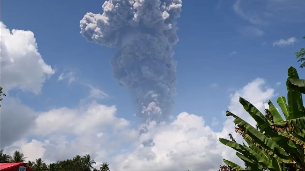
The activity status of Mount Ibu has been upgraded from the previous Alert, currently to Alert or level IV on Wednesday afternoon by the Geological Agency of the Ministry of Energy and Mineral Resources (ESDM).
The increase in status was carried out after the Geological Agency team detected a significant increase in Mount Ibu's volcanic activity in the period 1-14 January 2025.
The officer of the Mount Ibu observation post in Gam Ici Village, West Halmahera, noted that the eruption averaged 70 events per day. In the January 2025 period, the height of the fluctuating eruption column was observed and symptoms of an increase in the height of the eruption column to a maximum of 4 kilometers from above the peak.
In this time range, 748 earthquake eruptions were reported, 70 earthquake avalanches, 1,643 earthquake gusts, 6,976 shallow volcanic earthquakes, 346 deep volcanic earthquakes, 60 local tectonic earthquakes, with a dominant amplitude of 3 millimeters.
That way the Geological Agency urges the people around Mount Ibu and tourists not to move within a five-kilometer radius and to expand sectorally 6 kilometers to the crater opening in the northern part of the active crater of Mount Ibu.
The English, Chinese, Japanese, Arabic, and French versions are automatically generated by the AI. So there may still be inaccuracies in translating, please always see Indonesian as our main language. (system supported by DigitalSiber.id)


