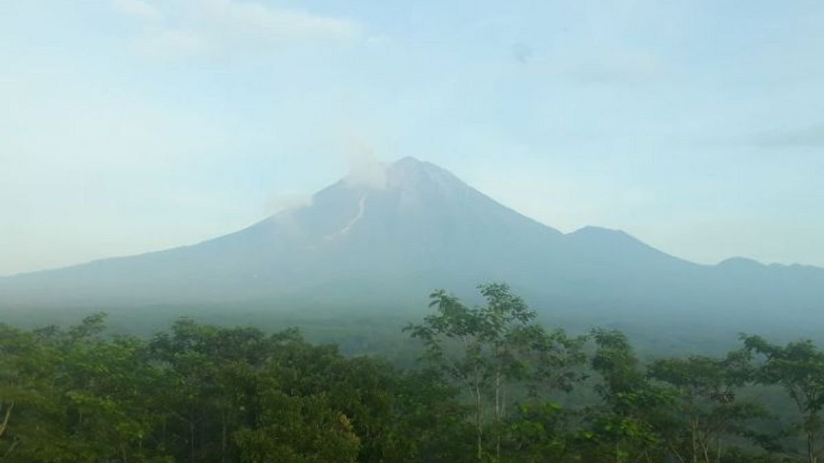


LUMAJANG - Semeru erupted 24 times in the observation period for the last 12 hours or on Thursday, March 24 from 00.00 to 12.00 WIB.
The mountain, which has a height of 3,676 meters above sea level (masl) in Lumajang Regency, East Java, on Thursday at 00.00-06.00 WIB recorded 16 earthquakes with an amplitude of 10-22 mm and an earthquake duration of 95-115 seconds.
"Mount Semeru also experienced two gusts of earthquakes, two deep volcanic earthquakes, and one distant tectonic earthquake", said Liswanto, an officer of the Semeru Volcano Observation Post on Mount Sawur, in a written report submitted in Lumajang, Thursday, March 24, as reported by Antara.
Meanwhile, for the observation period on Thursday at 06.00-12.00 WIB, it was recorded that Mount Semeru experienced eight eruptions with an amplitude of 10-22 mm and an earthquake duration of 50-85 seconds so that during the last 12 hours Mount Semeru experienced 24 eruptions.
On Wednesday, March 23, said Liswanto, the activity of Mount Semeru recorded 68 eruptions/eruptions with an amplitude of 10-25 mm and an earthquake duration of 55-250 seconds, one hot cloud avalanche, one avalanche earthquake, six gust earthquakes, six earthquakes harmonics, two volcanic earthquakes, and three tectonic earthquakes.
Meanwhile, the Head of Emergency, Rehabilitation, and Reconstruction of the Lumajang Regional Disaster Management Agency (BPBD), Joko Sambang said that his party was always coordinating with PPGA Semeru officers in Gunung Sawur regarding the volcanic activity.
"Mount Semeru's activity is currently still on alert status since December 16, 2021, so the public is advised to comply with several recommendations submitted by the Center for Volcanology and Geological Hazard Mitigation (PVMBG)", he said.
SEE ALSO:
-
 | BERITA
KSP Minta Badan Otorita Cermat Identifikasi Pemilikan Tanah di IKN Nusantara
24 Maret 2022, 10:25 -
 | BERITA
Presiden Jokowi Harap Taman Wisata Baru Ubah Wajah Destinasi Wisata Kupang
24 Maret 2022, 09:33

He explained that the community was advised not to carry out any activities in the southeast sector along Besuk Kobokan as far as 13 km from the summit (the center of the eruption) and beyond that distance, the community is not allowed to carry out activities at a distance of 500 meters from the river bank (river border) along Besuk Kobokan because it has the potential to be affected by the expansion of hot clouds and lava flows up to a distance of 17 km from the summit.
"People are also not allowed to move within a 5 km radius from the crater/peak of Mount Semeru because it is prone to the danger of throwing stones (incandescent)", he said.
The public is advised to be aware of the potential for hot clouds of avalanches, lava avalanches, and lahars along rivers/valleys that originate at the summit of Mount Semeru, especially along Besuk Kobokan, Besuk Bang, Besuk Kembar, and Besuk Sat as well as potential lahars in small rivers. which is a tributary of Besuk Kobokan.
The English, Chinese, Japanese, Arabic, and French versions are automatically generated by the AI. So there may still be inaccuracies in translating, please always see Indonesian as our main language. (system supported by DigitalSiber.id)


Related News