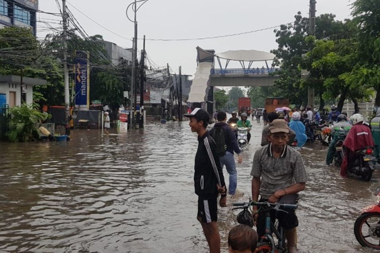
The Impact Of Last Night's Rain, 42 Jakarta Street Points Inundated

JAKARTA - Flood is still one of the main problems in Jakarta. The proof, the rain that has flushed since night, has an impact by submerging several areas in the capital city.
Based on police records, Tuesday, February 25, there were 42 flood spots throughout the Jakarta area. The most flooded areas are in North Jakarta.
Head of Public Relations of Polda Metro Jaya Kombes Yusri Yunus said that several roads, such as Pluit Raya road, Perintis traffic light, West Boulevad road, and Yos Sudarso road, were submerged to a height of 40 centimeters.
Meanwhile, the floods that occurred on Jalan Gunung Sahari in front of Jimbaran, and on National roads 1 and 2 in Penjaringan, were as high as 30 centimeters. The worst occurred in Cakung KBN in the direction of Priok, Kodamar, and in front of AM Sunter, reaching 50 sentimers.
"The floods that occurred in North Jakarta were at 10 points where the water level reached 30 to 50 centimeters," said Yusri, Tuesday, February 25.
The next areas that were most flooded were Central and West Jakarta. The two regions each have 9 flood points.
For the Central Jakarta area, the water level reaches 30 to 100 centimeters. The flood spot is located in the Kebon Sirih traffic light area towards the Serong Bridge, Bendungan Hilir (Benhil), and Jalan Ahmad Yani PLN Cempaka Putih, as high as 50 centimeters.
Then, on Cikini Raya street, Diponegoro street, KH Hasyim Ashari street, and in front of Atma Jaya University, the flood was 30 centimeters high. Meanwhile, the worst point is the Senen underpass with a height of 100 centimeters.
Meanwhile, for the West Jakarta area, floods occurred in Green Garden as high as 60 centimeters, Jalan Satria Grogol, Taman Kota, Jembatan 2, and Jalan Arjuna reaching 50 centimeters. For S Parman, Jalan Tanjung Duren Raya, and in front of Citraland, the water level reaches 40 centimeters.
11:26 Wadir Then PMJ helps motorists lift their vehicles over the road divider to avoid flooding on Jl. Daan Mogot West Jakarta. pic.twitter.com/wvC0XC4POA
- TMC Polda Metro Jaya (@TMCPoldaMetro) February 25, 2020
Furthermore, South and East Jakarta, each of which has 7 flood-affected areas. Flood points as high as 20 to 30 centimeters are in Grand Kemang, in front of Balai Kartini, Kompleks Pati, Jalan Kapten Tendean.
For the Rasuna Said road in front of the KPK, the Bukit Duri road in front of SMA 8, floods were recorded as high as 50 centimeters. Meanwhile, for Aspol Pondok Karya it reaches a height of 80 centimeters.
"Several locations have started to recede. One of them is in front of Balai Kartini," said Yusri.
In East Jakarta, a flood spot as high as 40 centimeters occurred in front of the East Satwil, Panjaitan and Exodus Toll Becak Kayu, as well as Jalan Ahmad Yani. Furthermore, the Arion traffic light is as high as 50 centimeters. Then, in front of Wika, 70 centimeters of water was stagnant, the Bambu Apus traffic light and the Ceramic traffic light were 80 centimeters high.
Odd-even does not apply
With flood conditions in dozens of points spread across Jakarta, the Traffic Directorate of Polda Metro Jaya does not apply an odd-even system until conditions return to normal or the water has receded.
"Gage is not being enforced at this time because it is situational that there are several locations that are inundated by water. Until now it has not been enforced," said Head of Sub-Directorate of Gakkum, Ditlantas Polda Metro Jaya ABKP Fahri Siregar.
In fact, to unravel the congestion caused by flooding, drivers of two-wheeled vehicles or motorbikes are allowed to cross the freeway or toll road.
It is recorded that there are three toll roads that are allowed to be traversed, namely the Jagorawi Toll Gate to the Taman Mini 2-Way Toll in the direction of Priok, which is issued at the Off Ramp of the Jaya Military Command. Then, the Wiyoto Wiyono Toll Gate at the Kebon Nanas Toll Gate was issued at the Cempaka Putih Off Ramp and vice versa. Then, the Becakayu Toll, from Bekasi towards Jakarta, was issued at the Pondok Kelapa Off Ramp.
"For motorbikes, it can pass on three toll roads," Fahri briefly.
