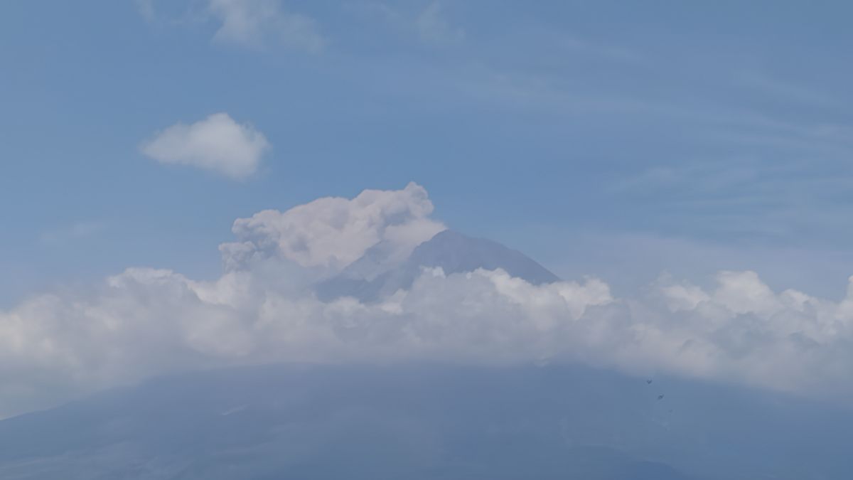


JATIM - Mount Semeru erupted on Wednesday, November 8 at 10:53 WIB. The mountain in East Java launched hot clouds up to one kilometer to Besuk Kobokan.
Citing a press release from the Center for Volcanology and Geological Hazard Mitigation (PVMBG) via Antara, Mount Semeru Observation Post Officer Ghufron Alwi said that the eruption was recorded on a 142-second seismograph and had a maximum amplitude of 22 mm.
According to him, the height of the eruption column is approximately 700 m above the peak or 4,376 meters above sea level. The ash column is white, gray, to brown, thick, and leans south and southwest.
Mount Semeru from January 1 to November 8, 2023, was recorded as experiencing 39 eruptions. The status of the volcano is currently Level III or Alert.
PVMBG advised the public not to carry out any activities in the southeast sector along Besuk Kobokan, as far as 13 kilometers from the summit (the center of the eruption).
The community is also asked not to carry out activities at a distance of 500 meters from the riverbank (river border) along Besuk Kobokan up to 17 kilometers from the summit because it has the potential to be affected by hot clouds and lava flows.
In addition, PVMBG asked residents not to move in areas within a radius of five kilometers from the peak of Mount Semeru because it is prone to the danger of throwing stones (pijar).
The public is asked to be aware of the potential for hot clouds of avalanches as well as lava avalanches and lahars along rivers/valleys that originate at the peak of Mount Semeru, especially along Besuk Kobokan, Besuk Bang, Besuk Kembar, and Besuk Sat, as well as the potential for lahars in small rivers that are tributaries of Besuk Kobokan.
The English, Chinese, Japanese, Arabic, and French versions are automatically generated by the AI. So there may still be inaccuracies in translating, please always see Indonesian as our main language. (system supported by DigitalSiber.id)
العلامات الأكثر شيوعًا
#Prabowo Subianto #السنة الجديدة #سوريا #ناتارو #عيد الميلادجمع